Nevada 4X4 Trails and Way Points
 05-12-2010, 06:54 PM
#1
JK Jedi
Thread Starter
Join Date: Nov 2007
Location: Copperopolis Ca
Posts: 5,022
Likes: 0
Received 0 Likes
on
0 Posts
Nevada 4x4 Trails and Way points!
We have started a small database of GPS way points marking different trail heads, campsites and other off-road points of interest in Nevada. We will be updating this file on a regular basis as new way points are visited.
If you have a contribution please feel free to post it.
Feel free to give us as much information about the way point as you like. Just make sure that your coordinates are in the WGS84 format.
The file can be downloaded below in the GPS exchange file format (GPX)-- it can be opened in most GPS/mapping programs including Garmin Mapsource, Magellan Mapsend, National Geographic Topo! and Google Earth.
NOTE: These way points are to be used at your own risk and their accuracy is not guaranteed. Just because a way point is listed does not mean it is always accessible to vehicle travel. Know before you go and always tread lightly!
 05-13-2010, 05:27 PM
#2
JK Enthusiast
Join Date: Aug 2009
Location: Henderson, Nv
Posts: 125
Likes: 0
Received 0 Likes
on
0 Posts
Trail goes to 8,200 ft. then back to around 4,250ft. Steep loose climb to the top, short driving on paved roads, natural springs and lots of wildlife. Desert pinstripe, probable STOCK FRIENDLY! with an experienced driver or spoter. Can be tretchorus if tried in winter, with snow on the ground. Very remote please travel with another 4-wheel-drive use the buddy system. Once you hit dirt, trail can last up to 7 hours, depending on the size of the group. Lunch break, pit stops, ect. can make the trail faster or slower.
Last edited by Randy James; 05-13-2010 at 05:42 PM.
05-14-2010, 07:05 PM
#4
JK Jedi
Thread Starter
Join Date: Nov 2007
Location: Copperopolis Ca
Posts: 5,022
Likes: 0
Received 0 Likes
on
0 Posts
There is no data base...... unless we can figure where to make one???? Iam trying to figure this out for us to all use. Randy and I were trying to post google earth links but it didnt work. Any suggestions?
Preston any computer savvy here will be greatly appreciated.
Preston any computer savvy here will be greatly appreciated.
06-03-2010, 06:06 AM
#5
JK Super Freak
Join Date: Oct 2007
Location: Las Vegas, NV
Posts: 1,156
Likes: 0
Received 0 Likes
on
0 Posts
There is no data base...... unless we can figure where to make one???? Iam trying to figure this out for us to all use. Randy and I were trying to post google earth links but it didnt work. Any suggestions?
Preston any computer savvy here will be greatly appreciated.
Preston any computer savvy here will be greatly appreciated.
http://maps.google.com/maps?f=q&sour...evada&t=h&z=15
06-03-2010, 10:48 AM
#6
JK Super Freak
Join Date: Oct 2007
Location: Las Vegas, NV
Posts: 1,156
Likes: 0
Received 0 Likes
on
0 Posts
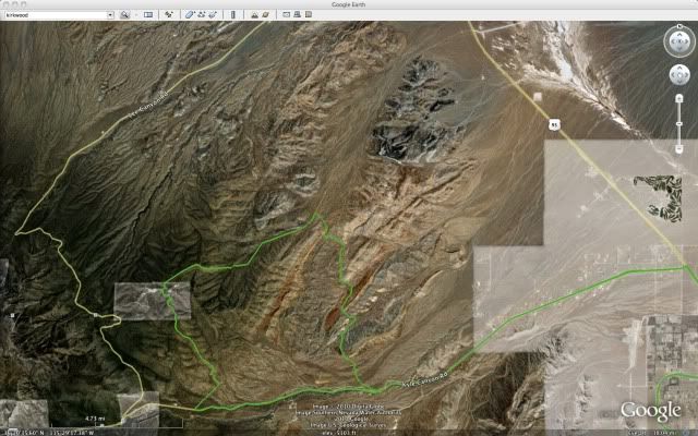
Ok, here's what they've done in the SoCal section. When you are on the "Reply to Thread" page like I am now writing this, there's an icon for "Attachments". If you have a kmz file or Google Earth track or file, then you can attach that to the post and anyone with google earth should be able to download it and open it with Google Earth. If you have something uploaded to Google Maps you can simply paste the link that's located in the map:
Nelson, NV
http://maps.google.com/maps?f=q&sour...evada&t=h&z=14
You can also just place waypoints on here. See:
https://www.jk-forum.com/forums/show...-and-Waypoints!
Nelson, NV
http://maps.google.com/maps?f=q&sour...evada&t=h&z=14
You can also just place waypoints on here. See:
https://www.jk-forum.com/forums/show...-and-Waypoints!
06-11-2010, 05:44 PM
#7
JK Newbie
Join Date: Feb 2009
Location: Las Vegas, NV
Posts: 98
Likes: 0
Received 0 Likes
on
0 Posts
Can someone tell me where the trailhead is for Copper Cache. I have wheeled around Nelson and don't believe I've seen it, but i want to check it out.
I may head out there tomorrow morning.
I may head out there tomorrow morning.
Trending Topics
06-14-2010, 08:36 AM
#10
JK Newbie
Join Date: Feb 2009
Location: Las Vegas, NV
Posts: 98
Likes: 0
Received 0 Likes
on
0 Posts
Thanks for letting me tag along on the run of copper cache. I had a good time and had been wanting to try that trail for a while.
Hopefully I can get in on some more stuff in the future.
Hopefully I can get in on some more stuff in the future.