


Bald Mountain trails question


Thread Starter
JK Freak

Joined: Aug 2011
Posts: 616
Likes: 25
From: Mesquite, NV
 Bald Mountain trails question
I'll be doing Bald Mountain from the south side in a week or so with a group of friends. I'm putting some waypoints and routes into my GPS before the trail and would like to get Bald Mountain right.
Everything I've seen indicates that the south loop is good to go.
My Charles Wells guide shows a route through the north loop to the top and then down the south loop - but it was written in 2004. It's north loop takes off just 0.3 mile from Rock Creek Road.
This forum's GPS coordinates sticky indicates that the north loop is closed. Both my 2008 National Geographic map and the current SNF website map look like the old north loop takeoff at 0.3 miles in the Wells guide is closed. They both show a spur 9S43B (26E211) heading north from the south loop just before Big Shot and indicate that you can take that spur and continue to the top via the upper end of the north loop.
Does anyone know whether the north loop is open? Does it now take off at the 9S34B (26E211) spur just before Big Shot? Or can you still take it 0.3 miles into the trail from Rock Creek Road as shown in the Wells guide.
Appreciate anyone's input.
Everything I've seen indicates that the south loop is good to go.
My Charles Wells guide shows a route through the north loop to the top and then down the south loop - but it was written in 2004. It's north loop takes off just 0.3 mile from Rock Creek Road.
This forum's GPS coordinates sticky indicates that the north loop is closed. Both my 2008 National Geographic map and the current SNF website map look like the old north loop takeoff at 0.3 miles in the Wells guide is closed. They both show a spur 9S43B (26E211) heading north from the south loop just before Big Shot and indicate that you can take that spur and continue to the top via the upper end of the north loop.
Does anyone know whether the north loop is open? Does it now take off at the 9S34B (26E211) spur just before Big Shot? Or can you still take it 0.3 miles into the trail from Rock Creek Road as shown in the Wells guide.
Appreciate anyone's input.

JK Enthusiast

Joined: Nov 2012
Posts: 161
Likes: 29
From: Fresno,CA
I'll be doing Bald Mountain from the south side in a week or so with a group of friends. I'm putting some waypoints and routes into my GPS before the trail and would like to get Bald Mountain right.
Everything I've seen indicates that the south loop is good to go.
My Charles Wells guide shows a route through the north loop to the top and then down the south loop - but it was written in 2004. It's north loop takes off just 0.3 mile from Rock Creek Road.
This forum's GPS coordinates sticky indicates that the north loop is closed. Both my 2008 National Geographic map and the current SNF website map look like the old north loop takeoff at 0.3 miles in the Wells guide is closed. They both show a spur 9S43B (26E211) heading north from the south loop just before Big Shot and indicate that you can take that spur and continue to the top via the upper end of the north loop.
Does anyone know whether the north loop is open? Does it now take off at the 9S34B (26E211) spur just before Big Shot? Or can you still take it 0.3 miles into the trail from Rock Creek Road as shown in the Wells guide.
Appreciate anyone's input.
Everything I've seen indicates that the south loop is good to go.
My Charles Wells guide shows a route through the north loop to the top and then down the south loop - but it was written in 2004. It's north loop takes off just 0.3 mile from Rock Creek Road.
This forum's GPS coordinates sticky indicates that the north loop is closed. Both my 2008 National Geographic map and the current SNF website map look like the old north loop takeoff at 0.3 miles in the Wells guide is closed. They both show a spur 9S43B (26E211) heading north from the south loop just before Big Shot and indicate that you can take that spur and continue to the top via the upper end of the north loop.
Does anyone know whether the north loop is open? Does it now take off at the 9S34B (26E211) spur just before Big Shot? Or can you still take it 0.3 miles into the trail from Rock Creek Road as shown in the Wells guide.
Appreciate anyone's input.
(559)855-5360 Ex 3302
Thread Starter
JK Freak
Joined: Aug 2011
Posts: 616
Likes: 25
From: Mesquite, NV
That's a problem for me since I have a bad voice that's hard to understand on the phone. I'd like to know from you guys who do the trail regularly where the takeoff is to the north loop that is open.
I'd also like to know whether you prefer going up to the top on the south or north loop.
I'd also like to know whether you prefer going up to the top on the south or north loop.
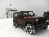
JK Newbie
Joined: Sep 2010
Posts: 95
Likes: 0
From: Clovis, CA.
When you take Dinky Creek Road, East from Shaver Lake, look for Rock Creek Road on the left (North), I think it's road 9S09. Follow that road for about 3 miles until you see a green gate on your left (West). There'll be a sign that says Bald Mountain. You'll pass Hollywood Hill, Big Shot and Possi Hill before you get to the top where the old fire lookout is. The map below is the most recent MVUM map provided by the forest service. You and your friends will have lots of fun!
http://www.fs.usda.gov/Internet/FSE_...rdb5393416.pdf
http://www.fs.usda.gov/Internet/FSE_...rdb5393416.pdf
Last edited by Classified; Aug 29, 2013 at 10:18 PM.
JK Newbie
Joined: Sep 2010
Posts: 95
Likes: 0
From: Clovis, CA.
Just reread your post: I prefer entering from the South as described above from Rock Creek Road. It's more challenging. As far as the 'loops' being open, I think all those trails are open. The upper left portion of the map I posted is all part of Bald Mtn. When are you going?
Thread Starter
JK Freak
Joined: Aug 2011
Posts: 616
Likes: 25
From: Mesquite, NV
Just reread your post: I prefer entering from the South as described above from Rock Creek Road. It's more challenging. As far as the 'loops' being open, I think all those trails are open. The upper left portion of the map I posted is all part of Bald Mtn. When are you going?
I'm going with 5 other couples from Sep 6-15 and we're staying in Wishon Village. Three of us will be driving JK's, one a Grand Cherokee and the other two Early Broncos. We don't have a specific day set for running a specific trail, it just depends on what we feel like doing since it's a vacation and we'll have 7 days there.
Thanks for your help.
JK Newbie
Joined: Sep 2010
Posts: 95
Likes: 0
From: Clovis, CA.
This should give you an idea of what the green gate looks like...
http://www.youtube.com/watch?v=viEVObybcIE
http://www.youtube.com/watch?v=viEVObybcIE
Trending Topics
Thread Starter
JK Freak
Joined: Aug 2011
Posts: 616
Likes: 25
From: Mesquite, NV
This should give you an idea of what the green gate looks like...
http://www.youtube.com/watch?v=viEVObybcIE
http://www.youtube.com/watch?v=viEVObybcIE