


Arizona Strip & Southern Utah Wanderings 2011


Thread Starter
JK Freak
Joined: Jan 2010
Posts: 520
Likes: 0
From: Grand Junction, CO
 Arizona Strip & Southern Utah Wanderings 2011
Parowan Gap & Little Black Mountain | Day 1
Saturday, October 1, 2011
The Original Trip Report on ADVENTR.CO
Saturday was the start of my annual 'Southern Utah Wanderings' trip that I usually go on in October. This year is a little different since I wanted to venture a little further south so that I could start exploring the Arizona Strip. Like last year, my friend Jared joined me on this trip. He headed down from the Salt Lake area after work on Friday and stayed at my house over night so that we could get an early start driving on Saturday morning.
Saturday would mostly be a driving day, but we did manage to make a few stops along the way. The first of them being a short side trip to the Parowan Gap. The Parowan Gap is one of Utah's best-known petroglyph sites, which is located in a 600-foot-deep notch through the Red Hills on the eastern edge of the Escalante Desert. I've been looking forward to visiting this site for some time.
The 'Zipper-Glyph' is probably the most well known petroglyph panel at the site. Some believe the main design that resembles a zipper is a map or a calendar....or maybe even both. All I know is that it is shaped just like the Parowan Gap that it is located near.
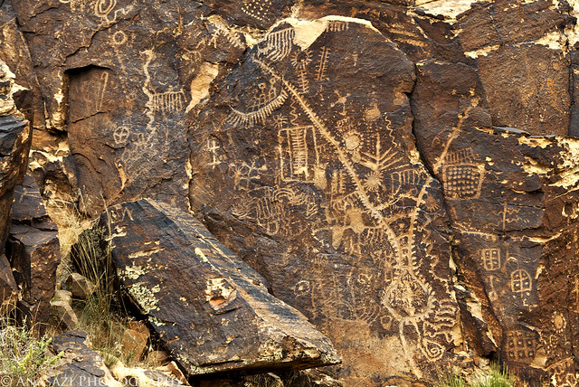
Zipper-Glyph by IntrepidXJ, on Flickr
A closer look at another petroglyph panel located next to the 'Zipper-Glyph'
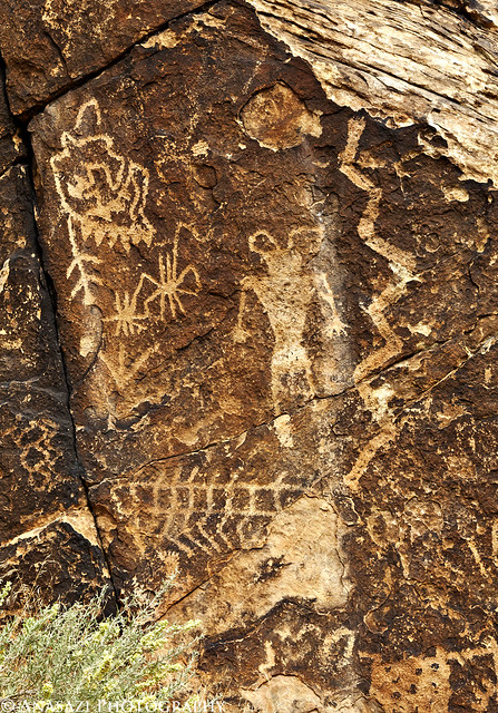
Snake-Man by IntrepidXJ, on Flickr
We walked through the gap keeping a lookout for petroglyphs along the way. When we reached the west side, this is the last boulder we found containing some petroglyphs.
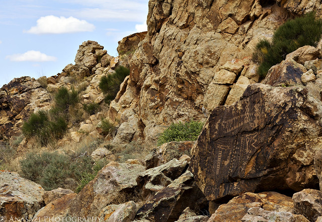
West Boulder by IntrepidXJ, on Flickr
Jared spotted these designs that were carved high up near the west side of the gap. I'm glad I had grabbed my long lens when I left the Jeep.
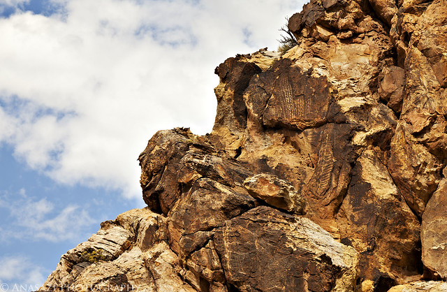
Upper Designs by IntrepidXJ, on Flickr
We found plenty of petroglyphs on the south side of the gap as well, including some in this small alcove.
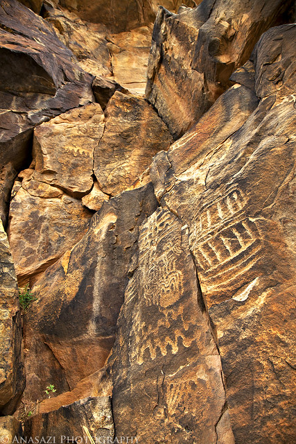
South Alcove Petroglyphs by IntrepidXJ, on Flickr
There were plenty of designs carved into the sandstone like this. These looked like they were pretty old compared to some of the others found in the area.
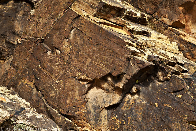
Large Faint Designs by IntrepidXJ, on Flickr
Here's an overall view of the 'Zipper-Glyph' and surrounding panels in their setting so you can get an idea of the location.
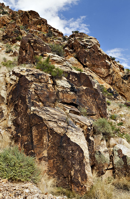
Parowan Gap Panels by IntrepidXJ, on Flickr
Before leaving the site, I thought it might be a good idea to get a photo of the actual Parowan Gap. The Jeep wasn't necessary, but I think it adds to the scene.

The Parowan Gap by IntrepidXJ, on Flickr
On our drive to the Parowan Gap, Jared though he had spotted some petroglyphs along the road so we investigated on the way back to the highway. It turns out he was right, so we hiked up to them and took a few photos. This is the main panel with the Little Salt Lake in the background.
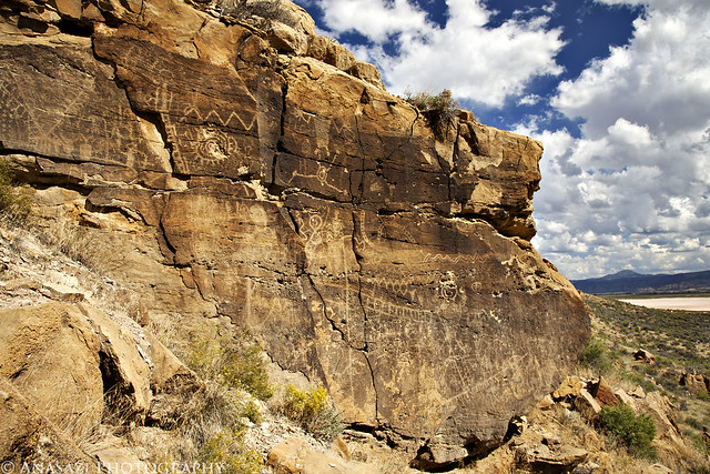
Little Salt Lake Panel by IntrepidXJ, on Flickr
A closer look at some of the petroglyphs found on the above panel.
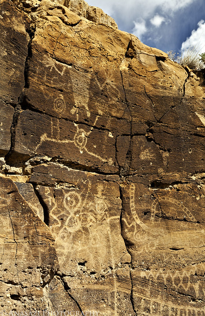
Big Hands by IntrepidXJ, on Flickr
After exploring the Parowan Gap area extensively, we were back on the interstate again headed south. Of course, we had to make the stop in Washington at In-N-Out for a Double Double for dinner. Once our appetites were satisfied we continued down into Arizona just over the border so that we could visit the Little Black Mountain petroglyph site. Apparently there are forty-four boulders located here that contain more than 500 petroglyphs. I'm pretty sure that we didn't find them all, but we did find many of them.
This is the Little Black Mountain. I know, it's not black...
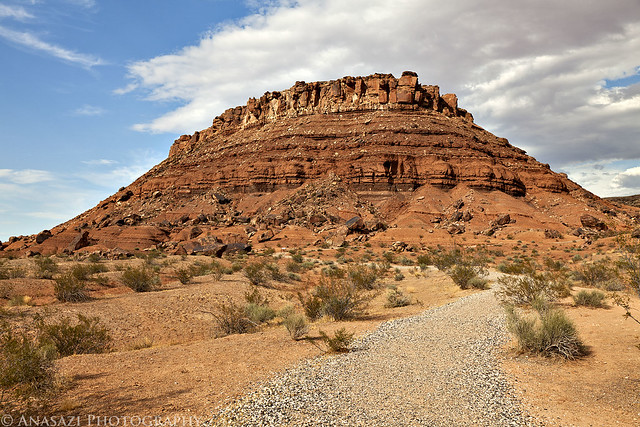
Little Black Mountain by IntrepidXJ, on Flickr
This was one of the more unique petroglyph settings at the site. The petroglyphs found here are carved on top of this large boulder. It looks like there is a natural pothole on top that holds water, which might be the reason this was an important place here in the desert.
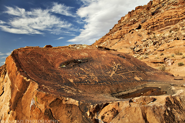
Boulder Top Petroglyphs by IntrepidXJ, on Flickr
Jared testing out the swivel screen on his new camera body which also helps give this site a little scale.
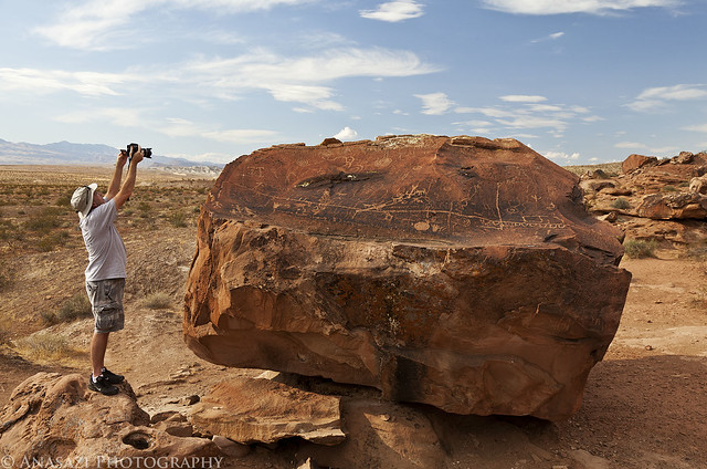
Getting the Shot by IntrepidXJ, on Flickr
Looking up at a smooth surface on a boulder containing more petroglyphs.
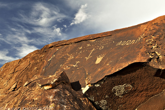
Upper Boulder Petorglyphs by IntrepidXJ, on Flickr
This panel was located on the back of a large boulder.
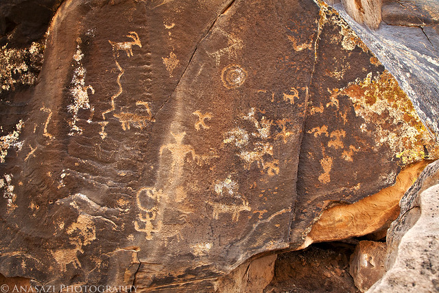
Back of the Boulder by IntrepidXJ, on Flickr
This sun figure was one of the more elaborate petroglyphs found here.
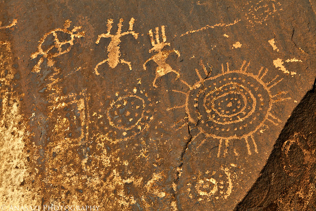
Dotted Sun by IntrepidXJ, on Flickr
A look at the large boulder containing the previous petroglyphs. If you look closely you can see plenty of older petroglyphs carved into the boulder with plenty of newer ones, too. This location was probably used for a long time.
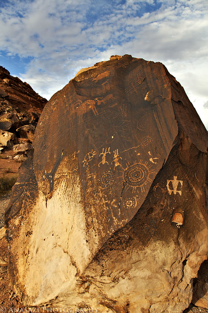
Dotted Sun Boulder by IntrepidXJ, on Flickr
A few faint and simple petroglyphs on a boulder that frames the landscape in the background nicely.
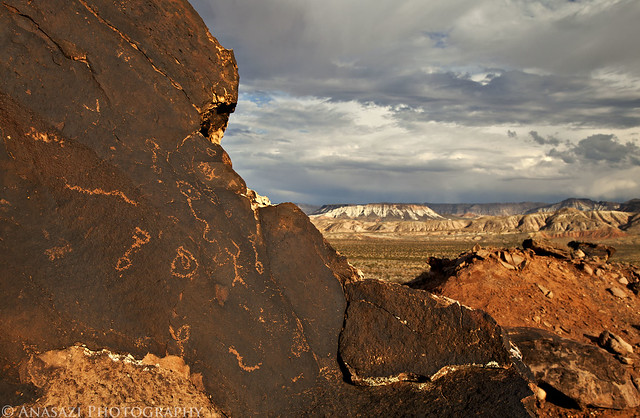
Framing the Landscape by IntrepidXJ, on Flickr
Jared photographing some petroglyphs located near ground level on a large boulder.
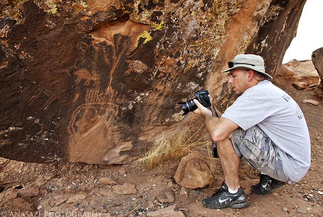
Low Petroglyphs by IntrepidXJ, on Flickr
After searching for petroglyphs at the base of Little Black Mountain for a while, it was starting to get late. We decided to setup camp nearby and then headed back over to get some sunset photos. Here's the large boulder containing a bunch of petroglyphs lit of by the setting sun with a few nice clouds in the background.
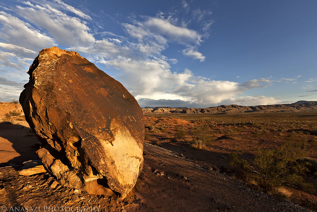
Petroglyph Sunset by IntrepidXJ, on Flickr
A view over Dutchman Wash as the landscape is bathed in the last sunlight of the day.
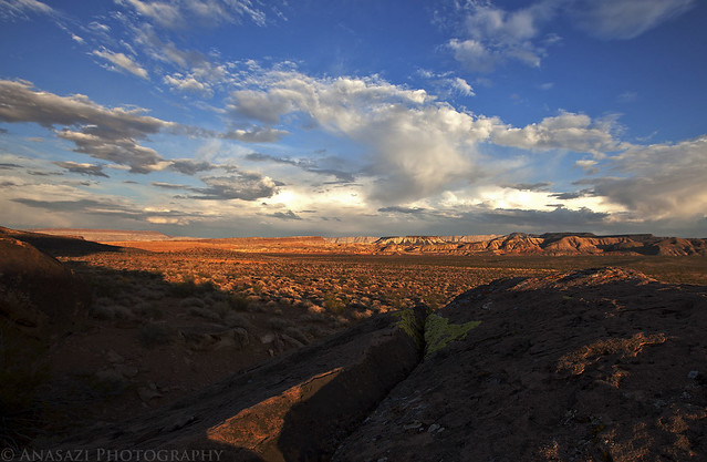
Dutchman Wash by IntrepidXJ, on Flickr
The clouds even got a little color as the sun dipped below the horizon. It was a great start to the trip.
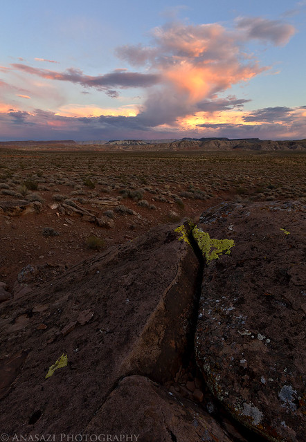
Dutchman Sunset by IntrepidXJ, on Flickr
Once the sun was down and the colors in the sky gone we hiked back over to camp so we could get some sleep. The weather was perfect. I ended up sleeping with my tent opened up so that I could have a great view of the night sky. I wish I had tried to take some night photos, but I figured that I would have plenty of other opportunities on the trip....I would be wrong.
>> Full Parowan Gap & Little Black Mountain Photo Gallery
Saturday, October 1, 2011
The Original Trip Report on ADVENTR.CO
Saturday was the start of my annual 'Southern Utah Wanderings' trip that I usually go on in October. This year is a little different since I wanted to venture a little further south so that I could start exploring the Arizona Strip. Like last year, my friend Jared joined me on this trip. He headed down from the Salt Lake area after work on Friday and stayed at my house over night so that we could get an early start driving on Saturday morning.
Saturday would mostly be a driving day, but we did manage to make a few stops along the way. The first of them being a short side trip to the Parowan Gap. The Parowan Gap is one of Utah's best-known petroglyph sites, which is located in a 600-foot-deep notch through the Red Hills on the eastern edge of the Escalante Desert. I've been looking forward to visiting this site for some time.
The 'Zipper-Glyph' is probably the most well known petroglyph panel at the site. Some believe the main design that resembles a zipper is a map or a calendar....or maybe even both. All I know is that it is shaped just like the Parowan Gap that it is located near.
Zipper-Glyph by IntrepidXJ, on Flickr
A closer look at another petroglyph panel located next to the 'Zipper-Glyph'
Snake-Man by IntrepidXJ, on Flickr
We walked through the gap keeping a lookout for petroglyphs along the way. When we reached the west side, this is the last boulder we found containing some petroglyphs.
West Boulder by IntrepidXJ, on Flickr
Jared spotted these designs that were carved high up near the west side of the gap. I'm glad I had grabbed my long lens when I left the Jeep.
Upper Designs by IntrepidXJ, on Flickr
We found plenty of petroglyphs on the south side of the gap as well, including some in this small alcove.
South Alcove Petroglyphs by IntrepidXJ, on Flickr
There were plenty of designs carved into the sandstone like this. These looked like they were pretty old compared to some of the others found in the area.
Large Faint Designs by IntrepidXJ, on Flickr
Here's an overall view of the 'Zipper-Glyph' and surrounding panels in their setting so you can get an idea of the location.
Parowan Gap Panels by IntrepidXJ, on Flickr
Before leaving the site, I thought it might be a good idea to get a photo of the actual Parowan Gap. The Jeep wasn't necessary, but I think it adds to the scene.
The Parowan Gap by IntrepidXJ, on Flickr
On our drive to the Parowan Gap, Jared though he had spotted some petroglyphs along the road so we investigated on the way back to the highway. It turns out he was right, so we hiked up to them and took a few photos. This is the main panel with the Little Salt Lake in the background.
Little Salt Lake Panel by IntrepidXJ, on Flickr
A closer look at some of the petroglyphs found on the above panel.
Big Hands by IntrepidXJ, on Flickr
After exploring the Parowan Gap area extensively, we were back on the interstate again headed south. Of course, we had to make the stop in Washington at In-N-Out for a Double Double for dinner. Once our appetites were satisfied we continued down into Arizona just over the border so that we could visit the Little Black Mountain petroglyph site. Apparently there are forty-four boulders located here that contain more than 500 petroglyphs. I'm pretty sure that we didn't find them all, but we did find many of them.
This is the Little Black Mountain. I know, it's not black...
Little Black Mountain by IntrepidXJ, on Flickr
This was one of the more unique petroglyph settings at the site. The petroglyphs found here are carved on top of this large boulder. It looks like there is a natural pothole on top that holds water, which might be the reason this was an important place here in the desert.
Boulder Top Petroglyphs by IntrepidXJ, on Flickr
Jared testing out the swivel screen on his new camera body which also helps give this site a little scale.
Getting the Shot by IntrepidXJ, on Flickr
Looking up at a smooth surface on a boulder containing more petroglyphs.
Upper Boulder Petorglyphs by IntrepidXJ, on Flickr
This panel was located on the back of a large boulder.
Back of the Boulder by IntrepidXJ, on Flickr
This sun figure was one of the more elaborate petroglyphs found here.
Dotted Sun by IntrepidXJ, on Flickr
A look at the large boulder containing the previous petroglyphs. If you look closely you can see plenty of older petroglyphs carved into the boulder with plenty of newer ones, too. This location was probably used for a long time.
Dotted Sun Boulder by IntrepidXJ, on Flickr
A few faint and simple petroglyphs on a boulder that frames the landscape in the background nicely.
Framing the Landscape by IntrepidXJ, on Flickr
Jared photographing some petroglyphs located near ground level on a large boulder.
Low Petroglyphs by IntrepidXJ, on Flickr
After searching for petroglyphs at the base of Little Black Mountain for a while, it was starting to get late. We decided to setup camp nearby and then headed back over to get some sunset photos. Here's the large boulder containing a bunch of petroglyphs lit of by the setting sun with a few nice clouds in the background.
Petroglyph Sunset by IntrepidXJ, on Flickr
A view over Dutchman Wash as the landscape is bathed in the last sunlight of the day.
Dutchman Wash by IntrepidXJ, on Flickr
The clouds even got a little color as the sun dipped below the horizon. It was a great start to the trip.
Dutchman Sunset by IntrepidXJ, on Flickr
Once the sun was down and the colors in the sky gone we hiked back over to camp so we could get some sleep. The weather was perfect. I ended up sleeping with my tent opened up so that I could have a great view of the night sky. I wish I had tried to take some night photos, but I figured that I would have plenty of other opportunities on the trip....I would be wrong.
>> Full Parowan Gap & Little Black Mountain Photo Gallery
Thread Starter
JK Freak
Joined: Jan 2010
Posts: 520
Likes: 0
From: Grand Junction, CO
Straddling the Border to Toroweap | Day 2
Sunday, October 2, 2011
The Original Trip Report on ADVENTR.CO
After an awesome night camping under the stars in perfect weather near Little Black Mountain, we were up early, had a little breakfast and were soon on our way back into Utah. Our ultimate destination for the day would be Toroweap on the North Rim of the Grand Canyon, but we would have a lot of exploring to do on our way there.
After entering Utah again, we quickly found ourselves in Warner Valley. As we headed east, we took the short detour to Fort Pearce which is located along the old Honeymoon Trail.
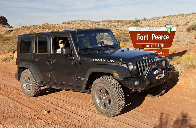
Fort Pearce Heritage Site by IntrepidXJ, on Flickr
Of course, our first objective at the site was to find the petroglyphs located near the fort. They were easy to find and the area offered a nice view.
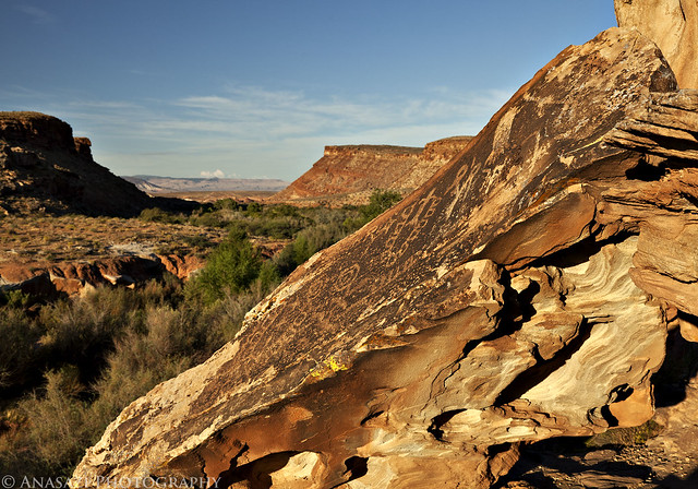
Fort Pearce Petroglyphs by IntrepidXJ, on Flickr
A closer look at the petroglyphs on the slanted boulder.
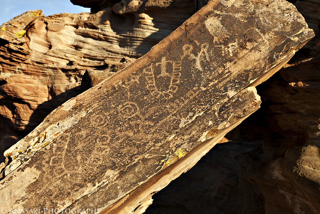
Fort Pearce Boulder by IntrepidXJ, on Flickr
After hiking down into the wash and finding some more petroglyphs and historic signatures, we went back up and visited Fort Pearce. This small structure is one of only three remaining stone guard posts built during Utah’s Black Hawk War. The “war” was actually period of intermittent raiding between 1865 and 1870. During this time period the Ute Tribe, led by Chief Black Hawk (Antonga), and other Native Americans allies attempted to drive the Mormons from the Ute traditional homelands.
To protect their herds and homes, local Mormon militia constructed a series of protected guard or sentry posts, called ‘forts’, along major trails and travel corridors in central and southern Utah. Four to six armed men with horses were stationed at each post, to attack and delay the Indian raiding parties, while a rider raced to the nearest settlements with a warning. Fort Pearce Wash was one of the primary routes along which Ute-Navajo horsemen traveled to raid the livestock herds and settlements of the St. George Basin.
No armed conflicts are known to have taken place at Fort Pearce, but the guard post was manned, at least intermittently, from 1866 until 1873, when peace negotiations and U.S. Army actions ended the raiding that was known in Utah as the Black Hawk War.
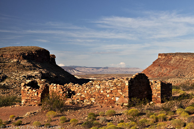
Fort Pearce by IntrepidXJ, on Flickr
Next up was a stop at the Warner Valley Dinosaur Trackway. There were a lot of tracks here....both large and small. Apparently, there are estimated to be about 400 tracks in the area, though many are covered with sand. Here are some of the better and larger tracks found at the site.
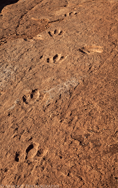
Dino Trackway by IntrepidXJ, on Flickr
Paleontologists cannot tell what specific dinosaur left a track, but they can be tied to a general group of them. Two types of tracks have been identified here belonging to the Grallator and Eubrontes groups, tracks ranging from 10-16 inches and about 7 inches respectively. Here's a closer look at a few larger tracks.
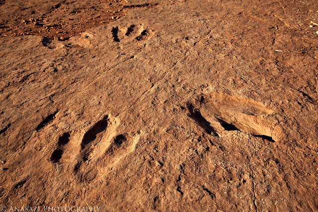
Dinosaur Tracks by IntrepidXJ, on Flickr
Here's my foot for a little scale. I wear a size 15 shoe.
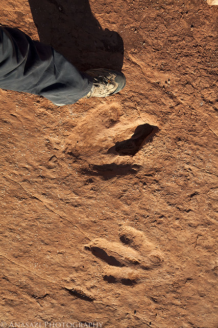
Size Comparison by IntrepidXJ, on Flickr
From Warner Valley we headed further north to Hurricane. This photo was taken along the way.
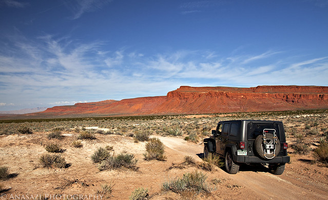
Red Cliffs by IntrepidXJ, on Flickr
Soon we were heading south towards Colorado City and Arizona again. Just before reaching the state line we turned off to visit one more site in Utah....Canaan Gap. I wasn't planning on fining too much at this site, but we were pleasantly surprised to find many interesting and unique petroglyphs here. These are some of the most interesting because of how deep they are. I do not believe that they were originally carved this deep and that they have eroded out over the years to become deeper.....but I might be wrong about that? However it happened, it's a pretty cool site!
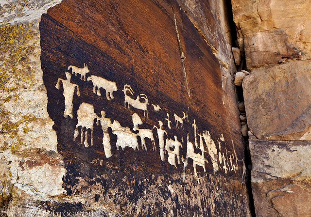
Canaan Gap Petroglyphs by IntrepidXJ, on Flickr
Here's a closer look at the right side of the panel I posted above.
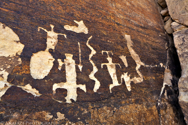
Canaan Deep Glyphs by IntrepidXJ, on Flickr
A closer look to see just how deep they are.
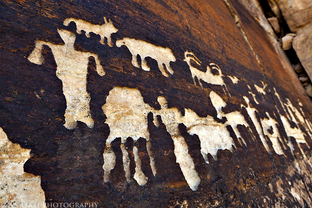
Deep by IntrepidXJ, on Flickr
Here's another very cool panel located at Canaan Gap. There is a lot going on in this one. It kind of reminds me of the Great Hunt Panel in Nine Mile Canyon because of the way all of the figures are grouped together. If you look at the very left side of the panel, there is even an upside-down anthropomorpic figure.
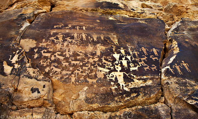
Busy Sheep Panel by IntrepidXJ, on Flickr
Before hiking back to the Jeep, Jared spotted a boulder that he thought we should check for more petroglyphs. It turns out his instinct was right, since we did find a few more deep petroglyphs located there.
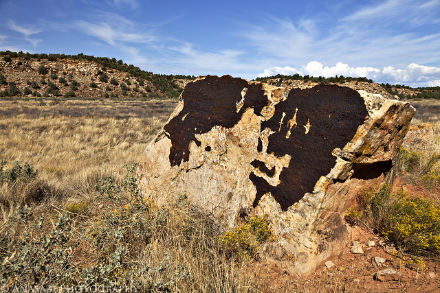
Boulder-Glyphs by IntrepidXJ, on Flickr
We fueled up the Jeep on the border and then were headed south into the Arizona Strip and towards the Grand Canyon and Toroweap.
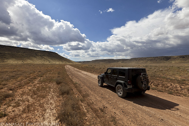
Arizona Strip Road by IntrepidXJ, on Flickr
More than half-way to Toroweap. I have always heard horror stories about how bad the roads are to Toroweap and that many people get two flat tires on their journey.....however, I was actually surprised at how well maintained the main roads were. Lots of high speed gravel road driving and kicking up dust.
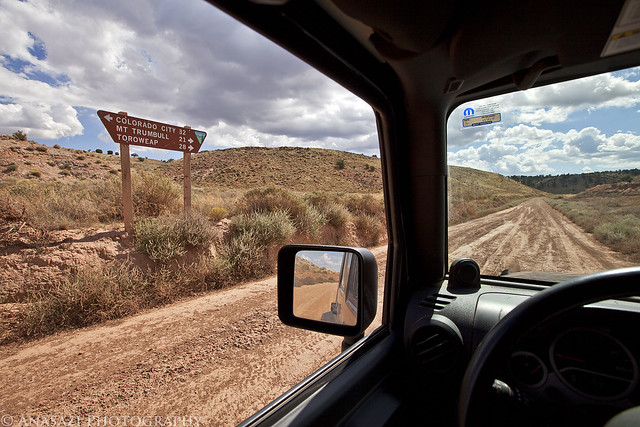
28 Miles by IntrepidXJ, on Flickr
We turned off the main road onto a little-used two-track so that we could visit another pictograph site. A storm is approaching in the distance.
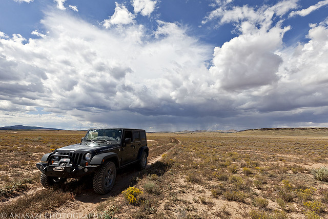
Two-Track & Storm by IntrepidXJ, on Flickr
Pretty soon we had reached Paiute Cave...a collapsed lava tube. This is the entrance. The trail down into it was over some rather large boulders and once inside the cave, there were plenty more loose boulders to scramble over as we explored the cave. It was pretty dark inside so a tripod was necessary for these photos. Unfortunately, getting the tripod setup in the jungle of boulders was challenging and frustrating at times......but worth it.
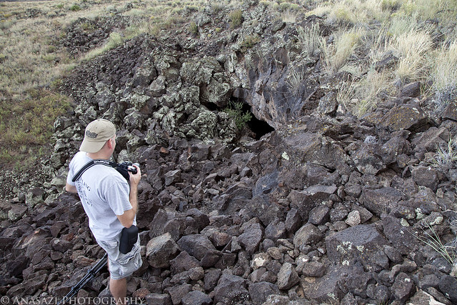
Paiute Cave by IntrepidXJ, on Flickr
Inside Paiute Cave are some of the most vibrant pictographs I have ever encountered...so far. While the cave is named after the Paiute, the amazing pictographs found hidden inside were actually created by the Virgin Kayenta Anazasi at least 600 years ago. I've posted a few photos below from this site.
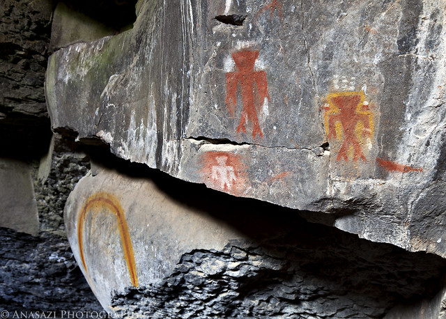
Three Colorful Anthropomorphs by IntrepidXJ, on Flickr
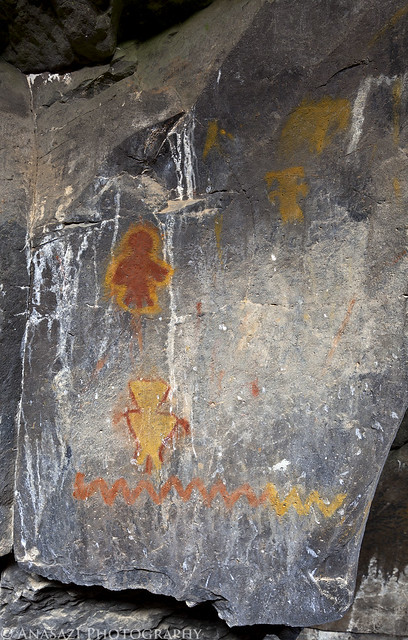
Neon Snake Panel by IntrepidXJ, on Flickr
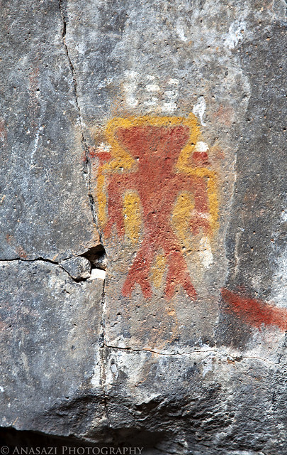
Paiute Cave Anthropomorph by IntrepidXJ, on Flickr
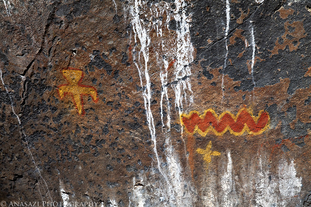
Red & Yellow by IntrepidXJ, on Flickr
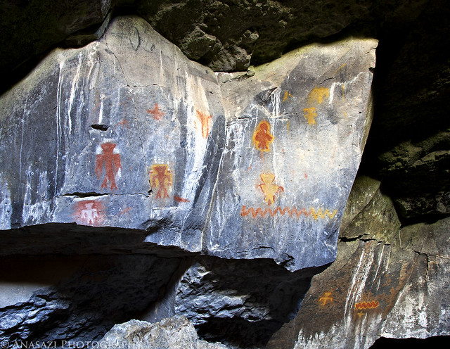
Paiute Cave Pictographs by IntrepidXJ, on Flickr
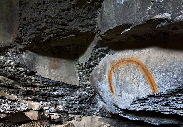
Hidden Rainbow by IntrepidXJ, on Flickr
When we finished up exploring Paiute Cave, we climbed back above ground to find that the storm that had been off in the distance was now overhead. The temperature outside had dropped at least ten degrees and the wind started to pick up. Luckily there were only a few sprinkles of rain.
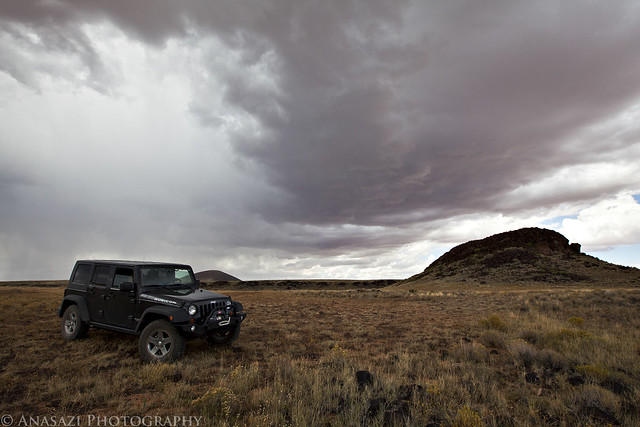
Storm, Jeep & Cinder Cone by IntrepidXJ, on Flickr
Entering the Grand Canyon - Parashant National Monument.
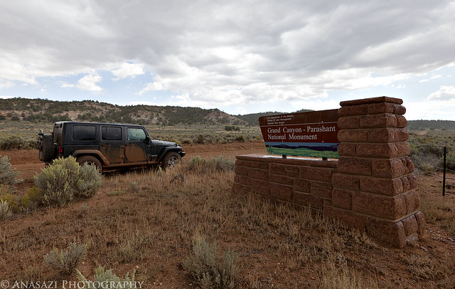
Grand Canyon - Parashant National Monument by IntrepidXJ, on Flickr
Pretty soon we were at our next destination, and last rock art site of the day....Nampaweap. Nampaweap means "foot canyon" in the Paiute language and is one of the largest known rock art sites on the Arizona Strip. This canyon could have been an important prehistoric travel corridor from the Grand Canyon to the resources of the ponderosa pine country near Mt. Trumbull.
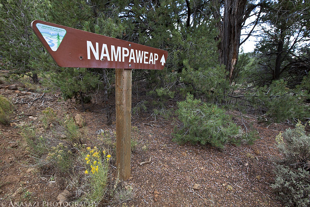
Nampaweap by IntrepidXJ, on Flickr
After following the short trail to the petroglyph site, this is one of the first boulders we found that had some petroglyphs on it.
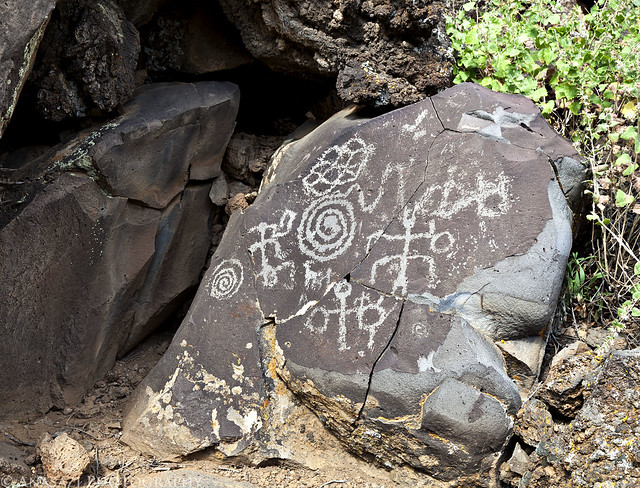
Nampaweap Boulder by IntrepidXJ, on Flickr
Then we started to realize just how many of the boulders and cliff faces in the area had petroglyphs carved into them.
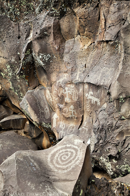
Nampaweap Spiral by IntrepidXJ, on Flickr
In places it seemed like almost every boulder had some kind of carving on it. It was hard to explore and watch our step so that we didn't step on or touch any of the petroglyphs.
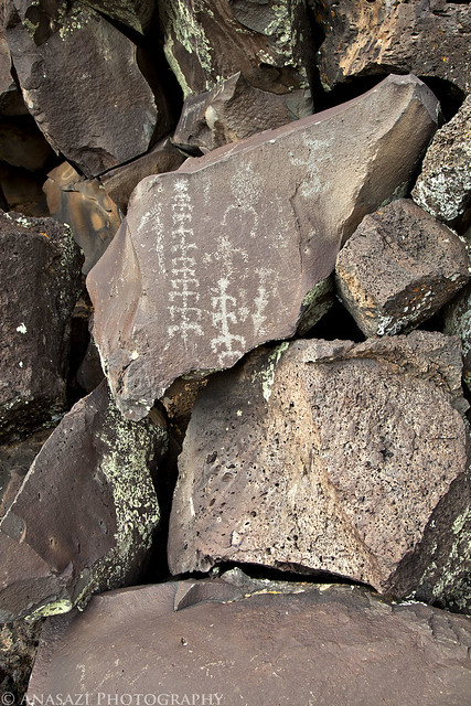
Centipede-Man by IntrepidXJ, on Flickr
Jared taking a photo of one of the many panels in the area.
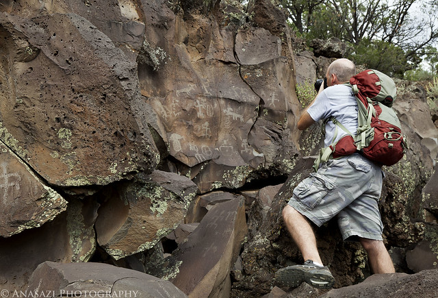
Jared at Nampaweap by IntrepidXJ, on Flickr
A line of small anthropomorphs hidden behind some boulders.
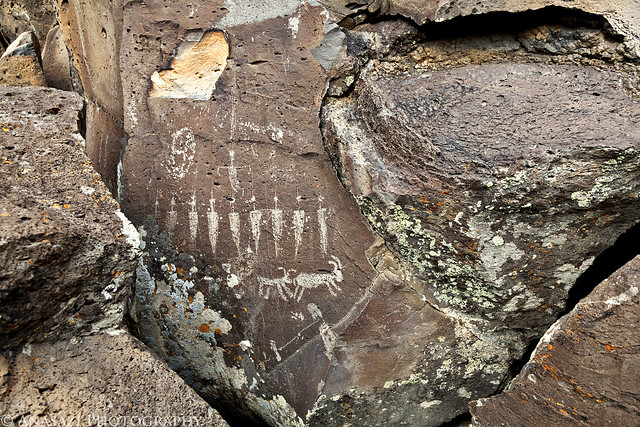
Small Hidden Lineup by IntrepidXJ, on Flickr
This boulder has a few sheep and one really elongated sheep carved on it.
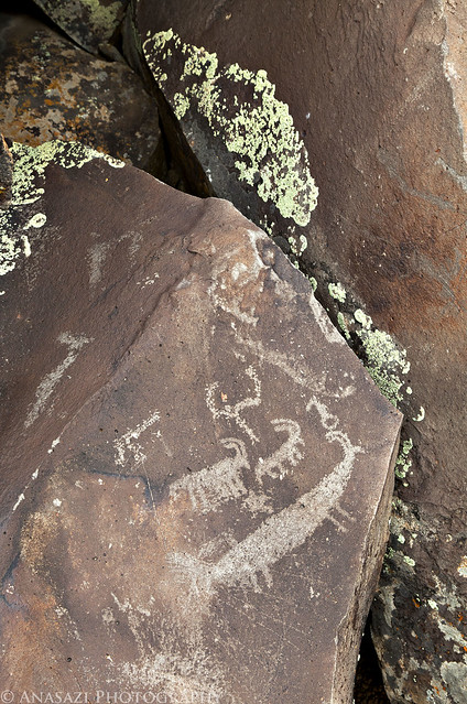
Long Sheep by IntrepidXJ, on Flickr
A typical scene found at Nampaweap.....boulders, petroglyphs and lichen. I found plenty of interesting compositions to photograph.
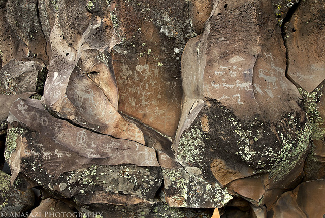
Nampaweap Scene by IntrepidXJ, on Flickr
Most of the time we spent exploring the site was spent with a cloudy overcast sky which helped keep the shadows away. However, shortly before we hiked back to the Jeep the clouds started to scatter and I was able to take a few photos with some blue sky.
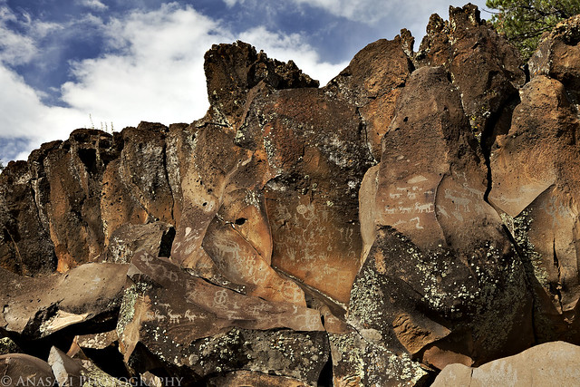
Many Nampaweap Petroglyphs by IntrepidXJ, on Flickr
This was an interesting spire-like boulder that protruded from a pile of other boulders. There also happened to be petroglyphs carved at it's base.
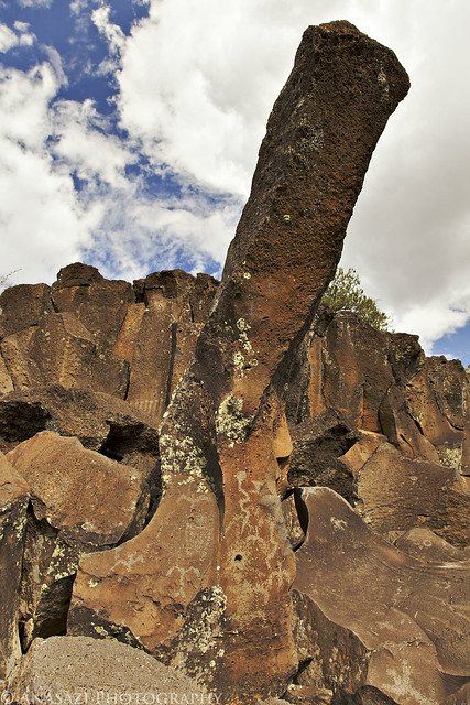
Spire Boulder Petroglyphs by IntrepidXJ, on Flickr
After we finished checking out Nampaweap it was back to the gravel roads on our way to Toroweap again.
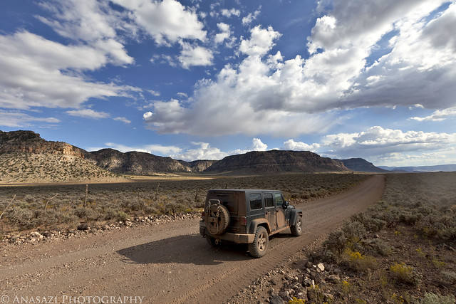
Road to Toroweap by IntrepidXJ, on Flickr
Finally, Grand Canyon National Park. This was actually my first visit there......never even been to the South Rim yet. I'm guessing the North Rim is more suited to me, though.

Welcome to the Grand Canyon by IntrepidXJ, on Flickr
After driving a few more miles into the park we went to check out the campground. I wasn't planning on camping within the park because I thought that they would charge you, but was pleasantly surprised to find out that camping is free. There are 10 sites and they are first come first served. We drove down the rough campground loop and found there were still two sites left, so we setup camp in site #4. When we had finished setting up camp it was dinner time, so we both had some dinner and then made our way over to the Toroweap Overlook for sunset.
After exploring the different viewpoints from the overlook, I settled on a view looking East. I composed the shot and waited for the sun to do the rest. The view from up there is amazing!
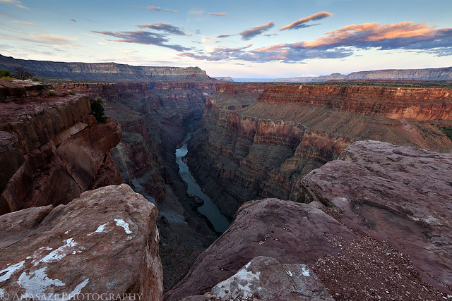
Toroweap Sunset East by IntrepidXJ, on Flickr
After photographing to the East for the sunset, Jared and I grabbed our cameras and tripods and started heading back to the Jeep. As we walked that way I noticed that the sky to the West was getting some nice color, so we quickly got back to the rim of the canyon, found a nice viewpoint and setup our cameras again before it was too late. This is my shot looking towards the west after the sun had dipped below the horizon.
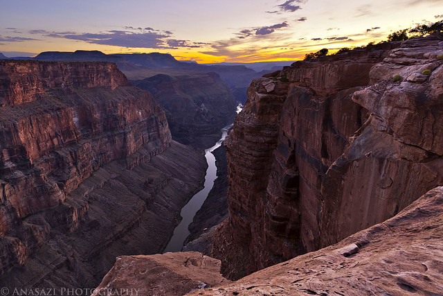
Toroweap Sunset West by IntrepidXJ, on Flickr
After it was dark out, we drove back to camp and got to bed. It had been a very long and exciting day and we were pretty tired (plus, I wanted to get up early for sunrise). This ended up being the busiest day of the entire trip. We visited a lot of new and interesting places and took a lot of photos. For the most part, the weather was pretty good. That, unfortunately, would not be the case for the rest of the trip. Rain, snow and cold temperatures were on the way...
Straddling the Border to Toroweap Photo Gallery
Sunday, October 2, 2011
The Original Trip Report on ADVENTR.CO
After an awesome night camping under the stars in perfect weather near Little Black Mountain, we were up early, had a little breakfast and were soon on our way back into Utah. Our ultimate destination for the day would be Toroweap on the North Rim of the Grand Canyon, but we would have a lot of exploring to do on our way there.
After entering Utah again, we quickly found ourselves in Warner Valley. As we headed east, we took the short detour to Fort Pearce which is located along the old Honeymoon Trail.
Fort Pearce Heritage Site by IntrepidXJ, on Flickr
Of course, our first objective at the site was to find the petroglyphs located near the fort. They were easy to find and the area offered a nice view.
Fort Pearce Petroglyphs by IntrepidXJ, on Flickr
A closer look at the petroglyphs on the slanted boulder.
Fort Pearce Boulder by IntrepidXJ, on Flickr
After hiking down into the wash and finding some more petroglyphs and historic signatures, we went back up and visited Fort Pearce. This small structure is one of only three remaining stone guard posts built during Utah’s Black Hawk War. The “war” was actually period of intermittent raiding between 1865 and 1870. During this time period the Ute Tribe, led by Chief Black Hawk (Antonga), and other Native Americans allies attempted to drive the Mormons from the Ute traditional homelands.
To protect their herds and homes, local Mormon militia constructed a series of protected guard or sentry posts, called ‘forts’, along major trails and travel corridors in central and southern Utah. Four to six armed men with horses were stationed at each post, to attack and delay the Indian raiding parties, while a rider raced to the nearest settlements with a warning. Fort Pearce Wash was one of the primary routes along which Ute-Navajo horsemen traveled to raid the livestock herds and settlements of the St. George Basin.
No armed conflicts are known to have taken place at Fort Pearce, but the guard post was manned, at least intermittently, from 1866 until 1873, when peace negotiations and U.S. Army actions ended the raiding that was known in Utah as the Black Hawk War.
Fort Pearce by IntrepidXJ, on Flickr
Next up was a stop at the Warner Valley Dinosaur Trackway. There were a lot of tracks here....both large and small. Apparently, there are estimated to be about 400 tracks in the area, though many are covered with sand. Here are some of the better and larger tracks found at the site.
Dino Trackway by IntrepidXJ, on Flickr
Paleontologists cannot tell what specific dinosaur left a track, but they can be tied to a general group of them. Two types of tracks have been identified here belonging to the Grallator and Eubrontes groups, tracks ranging from 10-16 inches and about 7 inches respectively. Here's a closer look at a few larger tracks.
Dinosaur Tracks by IntrepidXJ, on Flickr
Here's my foot for a little scale. I wear a size 15 shoe.
Size Comparison by IntrepidXJ, on Flickr
From Warner Valley we headed further north to Hurricane. This photo was taken along the way.
Red Cliffs by IntrepidXJ, on Flickr
Soon we were heading south towards Colorado City and Arizona again. Just before reaching the state line we turned off to visit one more site in Utah....Canaan Gap. I wasn't planning on fining too much at this site, but we were pleasantly surprised to find many interesting and unique petroglyphs here. These are some of the most interesting because of how deep they are. I do not believe that they were originally carved this deep and that they have eroded out over the years to become deeper.....but I might be wrong about that? However it happened, it's a pretty cool site!
Canaan Gap Petroglyphs by IntrepidXJ, on Flickr
Here's a closer look at the right side of the panel I posted above.
Canaan Deep Glyphs by IntrepidXJ, on Flickr
A closer look to see just how deep they are.
Deep by IntrepidXJ, on Flickr
Here's another very cool panel located at Canaan Gap. There is a lot going on in this one. It kind of reminds me of the Great Hunt Panel in Nine Mile Canyon because of the way all of the figures are grouped together. If you look at the very left side of the panel, there is even an upside-down anthropomorpic figure.
Busy Sheep Panel by IntrepidXJ, on Flickr
Before hiking back to the Jeep, Jared spotted a boulder that he thought we should check for more petroglyphs. It turns out his instinct was right, since we did find a few more deep petroglyphs located there.
Boulder-Glyphs by IntrepidXJ, on Flickr
We fueled up the Jeep on the border and then were headed south into the Arizona Strip and towards the Grand Canyon and Toroweap.
Arizona Strip Road by IntrepidXJ, on Flickr
More than half-way to Toroweap. I have always heard horror stories about how bad the roads are to Toroweap and that many people get two flat tires on their journey.....however, I was actually surprised at how well maintained the main roads were. Lots of high speed gravel road driving and kicking up dust.
28 Miles by IntrepidXJ, on Flickr
We turned off the main road onto a little-used two-track so that we could visit another pictograph site. A storm is approaching in the distance.
Two-Track & Storm by IntrepidXJ, on Flickr
Pretty soon we had reached Paiute Cave...a collapsed lava tube. This is the entrance. The trail down into it was over some rather large boulders and once inside the cave, there were plenty more loose boulders to scramble over as we explored the cave. It was pretty dark inside so a tripod was necessary for these photos. Unfortunately, getting the tripod setup in the jungle of boulders was challenging and frustrating at times......but worth it.
Paiute Cave by IntrepidXJ, on Flickr
Inside Paiute Cave are some of the most vibrant pictographs I have ever encountered...so far. While the cave is named after the Paiute, the amazing pictographs found hidden inside were actually created by the Virgin Kayenta Anazasi at least 600 years ago. I've posted a few photos below from this site.
Three Colorful Anthropomorphs by IntrepidXJ, on Flickr
Neon Snake Panel by IntrepidXJ, on Flickr
Paiute Cave Anthropomorph by IntrepidXJ, on Flickr
Red & Yellow by IntrepidXJ, on Flickr
Paiute Cave Pictographs by IntrepidXJ, on Flickr
Hidden Rainbow by IntrepidXJ, on Flickr
When we finished up exploring Paiute Cave, we climbed back above ground to find that the storm that had been off in the distance was now overhead. The temperature outside had dropped at least ten degrees and the wind started to pick up. Luckily there were only a few sprinkles of rain.
Storm, Jeep & Cinder Cone by IntrepidXJ, on Flickr
Entering the Grand Canyon - Parashant National Monument.
Grand Canyon - Parashant National Monument by IntrepidXJ, on Flickr
Pretty soon we were at our next destination, and last rock art site of the day....Nampaweap. Nampaweap means "foot canyon" in the Paiute language and is one of the largest known rock art sites on the Arizona Strip. This canyon could have been an important prehistoric travel corridor from the Grand Canyon to the resources of the ponderosa pine country near Mt. Trumbull.
Nampaweap by IntrepidXJ, on Flickr
After following the short trail to the petroglyph site, this is one of the first boulders we found that had some petroglyphs on it.
Nampaweap Boulder by IntrepidXJ, on Flickr
Then we started to realize just how many of the boulders and cliff faces in the area had petroglyphs carved into them.
Nampaweap Spiral by IntrepidXJ, on Flickr
In places it seemed like almost every boulder had some kind of carving on it. It was hard to explore and watch our step so that we didn't step on or touch any of the petroglyphs.
Centipede-Man by IntrepidXJ, on Flickr
Jared taking a photo of one of the many panels in the area.
Jared at Nampaweap by IntrepidXJ, on Flickr
A line of small anthropomorphs hidden behind some boulders.
Small Hidden Lineup by IntrepidXJ, on Flickr
This boulder has a few sheep and one really elongated sheep carved on it.
Long Sheep by IntrepidXJ, on Flickr
A typical scene found at Nampaweap.....boulders, petroglyphs and lichen. I found plenty of interesting compositions to photograph.
Nampaweap Scene by IntrepidXJ, on Flickr
Most of the time we spent exploring the site was spent with a cloudy overcast sky which helped keep the shadows away. However, shortly before we hiked back to the Jeep the clouds started to scatter and I was able to take a few photos with some blue sky.
Many Nampaweap Petroglyphs by IntrepidXJ, on Flickr
This was an interesting spire-like boulder that protruded from a pile of other boulders. There also happened to be petroglyphs carved at it's base.
Spire Boulder Petroglyphs by IntrepidXJ, on Flickr
After we finished checking out Nampaweap it was back to the gravel roads on our way to Toroweap again.
Road to Toroweap by IntrepidXJ, on Flickr
Finally, Grand Canyon National Park. This was actually my first visit there......never even been to the South Rim yet. I'm guessing the North Rim is more suited to me, though.
Welcome to the Grand Canyon by IntrepidXJ, on Flickr
After driving a few more miles into the park we went to check out the campground. I wasn't planning on camping within the park because I thought that they would charge you, but was pleasantly surprised to find out that camping is free. There are 10 sites and they are first come first served. We drove down the rough campground loop and found there were still two sites left, so we setup camp in site #4. When we had finished setting up camp it was dinner time, so we both had some dinner and then made our way over to the Toroweap Overlook for sunset.
After exploring the different viewpoints from the overlook, I settled on a view looking East. I composed the shot and waited for the sun to do the rest. The view from up there is amazing!
Toroweap Sunset East by IntrepidXJ, on Flickr
After photographing to the East for the sunset, Jared and I grabbed our cameras and tripods and started heading back to the Jeep. As we walked that way I noticed that the sky to the West was getting some nice color, so we quickly got back to the rim of the canyon, found a nice viewpoint and setup our cameras again before it was too late. This is my shot looking towards the west after the sun had dipped below the horizon.
Toroweap Sunset West by IntrepidXJ, on Flickr
After it was dark out, we drove back to camp and got to bed. It had been a very long and exciting day and we were pretty tired (plus, I wanted to get up early for sunrise). This ended up being the busiest day of the entire trip. We visited a lot of new and interesting places and took a lot of photos. For the most part, the weather was pretty good. That, unfortunately, would not be the case for the rest of the trip. Rain, snow and cold temperatures were on the way...
Straddling the Border to Toroweap Photo Gallery
Thread Starter
JK Freak
Joined: Jan 2010
Posts: 520
Likes: 0
From: Grand Junction, CO
Late Hike in a Deep Canyon | Day 3
Monday, October 3, 2011
The Original Trip Report on ADVENTR.CO
After a good night of sleep, we woke up on Monday morning early enough so that we could drive back over to the overlook at Toroweap and catch the sunrise. We set up our cameras at a viewpoint overlooking the Grand Canyon to the East.
The sun just peeking over the horizon with a great view down into the Grand Canyon.
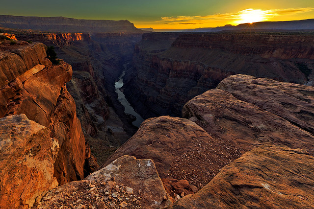
Sun-Kissed Canyon by IntrepidXJ, on Flickr
After taking some photos looking East, Jared and I headed over to get a view towards the West.
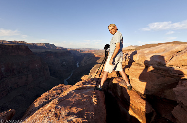
Jared at Toroweap by IntrepidXJ, on Flickr
Jared taking his shot.
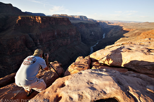
Taking the Shot by IntrepidXJ, on Flickr
Once we were done photographing the sunrise, we packed up camp and left Toroweap behind.
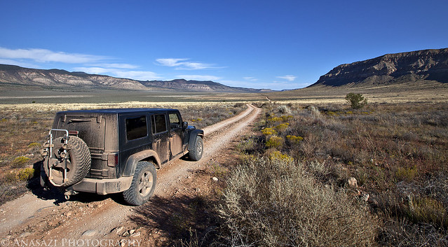
Leaving Toroweap by IntrepidXJ, on Flickr
After navigating through some narrow and rougher backroads outside of the National Park (getting plenty more pin-striping on my Jeep from the vegetation on the tight trails), we eventually reached our destination for the rest of the day; a remote side canyon within Grand Canyon National Park.
I'm pretty used to hiking down into canyons in Colorado and Southern Utah, so I didn't think much of hiking down into a side canyon of the Grand Canyon when I was planning the trip. However, once I got a view of the depth of this canyon from up here, it kind of hit me.....The Grand Canyon really is a deep hole in the earths crust! I wasn't looking forward to climbing back out of this canyon, but that didn't stop us from hiking down into it...
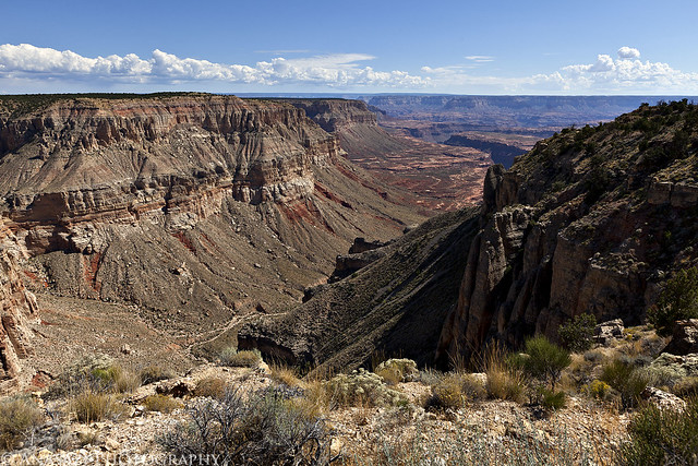
Long Way Down by IntrepidXJ, on Flickr
We had a little trouble finding the route down at first. Once we did find the start of the trail, it was still difficult to follow to the bottom of the canyon. It was an old stock trail that was constructed in places, but that sees very little use today. In places there wasn't much, if any, of a trail to follow, so we ended up doing a lot of route-finding. The way down was very steep and loose, plus we had to avoid a rattlesnake that wouldn't move away from the trail.
Once we were down in the canyon, the storm clouds started to roll in.
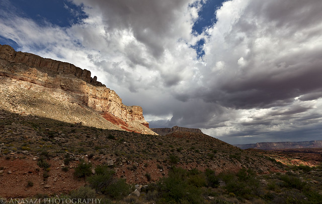
Storms Rolling In by IntrepidXJ, on Flickr
We were hoping to find some sort of faint trail down in the canyon, but that didn't seem to be the case. Most of our hike was navigating through the backcountry.
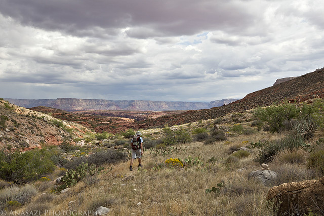
What Trail? by IntrepidXJ, on Flickr
More clouds and canyon scenery.
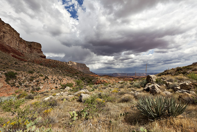
Cloudy Skies by IntrepidXJ, on Flickr
As we were finding our way down the canyon, we had to continuously be aware of and try to avoid all of the Prickly Pear growing here. It was a futile effort, though...and I was still picking out cactus needles from my legs the next day.
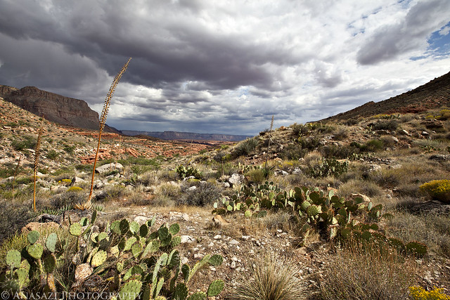
Prickly Pear Jungle by IntrepidXJ, on Flickr
<!--more-->
A view back up the canyon from where we had come.
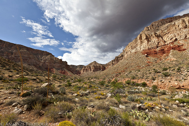
Up-Canyon by IntrepidXJ, on Flickr
More route-finding in the canyon.
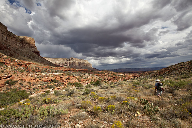
Hiking by IntrepidXJ, on Flickr
Some nice scenery, and luckily the clouds had not dropped any rain on us yet.
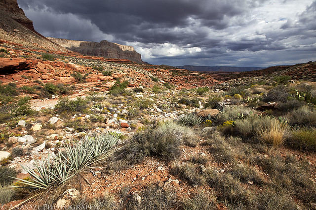
Backcountry by IntrepidXJ, on Flickr
Eventually we started to follow the wash which made the hiking a little easier.
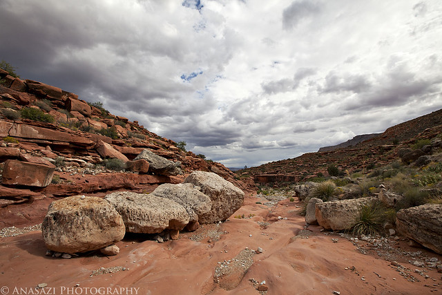
Boulders in the Wash by IntrepidXJ, on Flickr
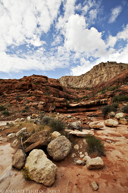
View from the Wash by IntrepidXJ, on Flickr
We kept following the wash until it became another canyon.
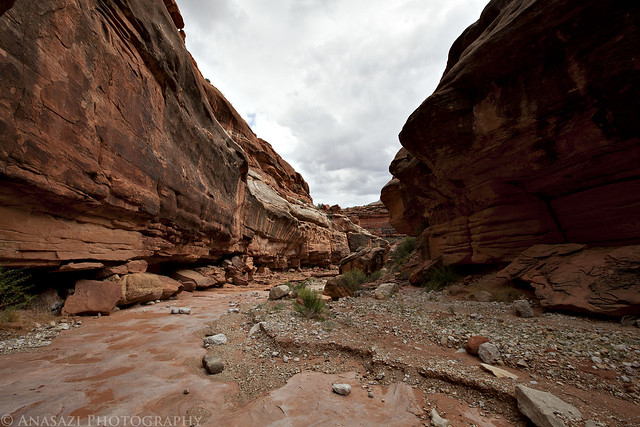
In the Canyon by IntrepidXJ, on Flickr
Soon after entering the smaller canyon we came across our first rock art of the day. It wasn't much, but there were quite a few dots organized into a few large square grid-like designs. It looked like these dots may have been fingerprints, based on their shape, so I'm referring to this site as the Fingerprint Shelter.
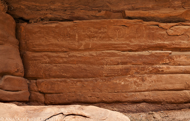
Fingerprint Shelter by IntrepidXJ, on Flickr
Here's a closer look at the grid made up of fingerprints.
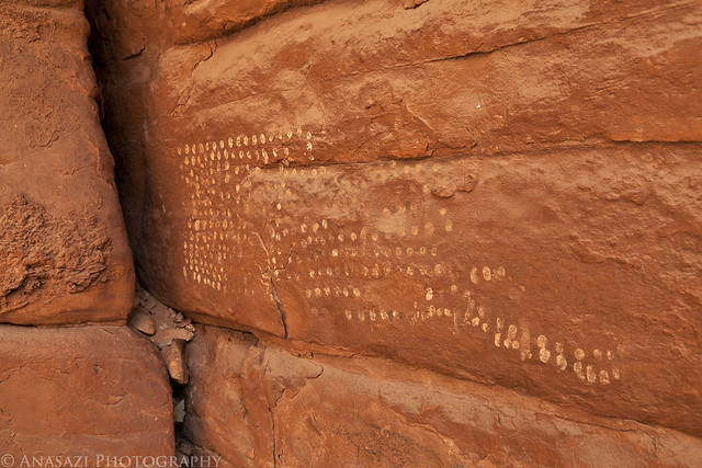
Fingerprint Designs by IntrepidXJ, on Flickr
Across the canyon from the Fingerprint Shelter we came across another large and low overhang that contained a lot of faint pictographs and a few petroglyphs. One of the more interesting pictographs at the site are these faded red lines. They remind me of the red line designs I saw at Weavers Caves over the summer.
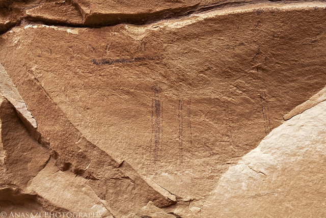
Red Lines by IntrepidXJ, on Flickr
A few more of the bigger white figures at this site. The largest white anthropomorph in outline is interesting.
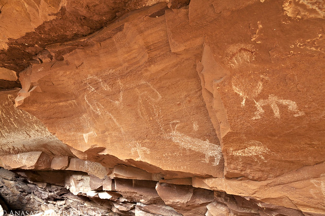
Outline by IntrepidXJ, on Flickr
We also found plenty of potsherds in this shelter.
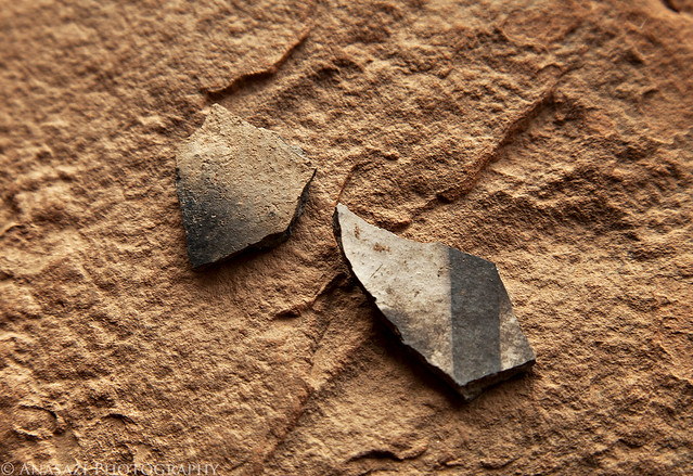
Potsherds by IntrepidXJ, on Flickr
A good sized anthropomorphic figure found at the site.
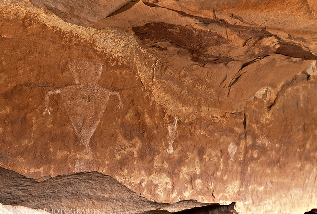
Triangle Torso by IntrepidXJ, on Flickr
After continuing on past this site we soon started hiking up an old constructed stock trail (where we could still find it) that lead up a smaller side canyon. A short way up that canyon we found some more pictographs high up on a ledge above, so we climbed up to them.
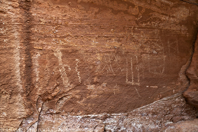
Faded Panel by IntrepidXJ, on Flickr
I really like the snake-like figure made up of small white dots. Very interesting!
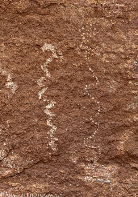
Fine Dotted Snake by IntrepidXJ, on Flickr
Then I spotted the panel I was looking for. The Cowboy Shelter Pictographs. I had no idea what they looked like and just a general idea of where they might be based on some research I had done for the trip. Looks like I guessed right! This is the first Grand Canyon Polychrome / Esplanade Style rock art that I have seen in person. Definitely a good find, even if it is kind of faded... If you look closely at the larger white figures in this panel, you can see that there is some fine detail done in red paint. There are also red snake-like lines that connect all of the figures together. You might need to click on the image to view a larger size on Flicker to see some of these details.
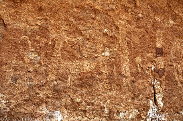
Cowboy Shelter Pictographs by IntrepidXJ, on Flickr
Here's a closer look at the red and white figure on the right side of the panel.
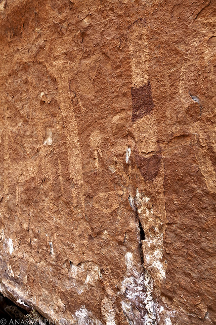
Red & White Figure by IntrepidXJ, on Flickr
A little further up the canyon we came across a cowboy camp at the end of the old stock trail.
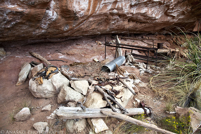
Cowboy Camp by IntrepidXJ, on Flickr
While this is known as a cowboy camp, it sure looks like there is a lot of mining equipment here, too. Maybe the cowboys prospected in their spare time? Or perhaps some miners moved in and used the camp after the cowboys had abandoned it?
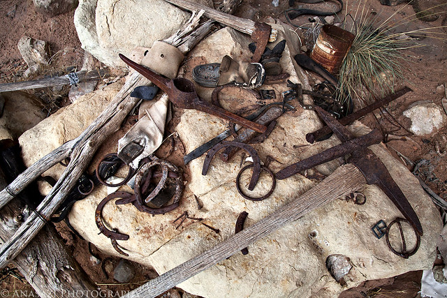
Gear by IntrepidXJ, on Flickr
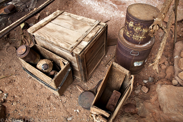
Camp Storage by IntrepidXJ, on Flickr
I took a peek inside the storage box.
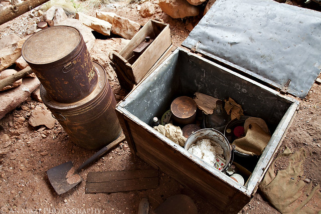
Inside the Box by IntrepidXJ, on Flickr
The real adventure began once we left the cowboy camp and started hiking back to the Jeep. We decided to continue up the small side canyon we were in and get up on the Esplanade level to hike back. This added some more distance to a hike that was already was much longer than we had anticipated. We also knew it was going to start getting dark soon and we needed to keep moving. While we were hiking back with no trail to follow and plenty of deeper washes to go around or through, the storm clouds that had been teasing us all day finally decided to let loose and pour down on us. We got soaked!
By the time we reached the bottom of the trail that would take us back out of the canyon, it was getting pretty dark out. I then realized that my headlamp was still in my Jeep and not in my backpack. Though the Jeep was technically only about a quarter mile from us at this point, it was over 1,000 feet above us still. Luckily, Jared had two small flashlights with him that we were able to use. It was tough enough finding our way down the old stock trail in the daylight, so getting back out in the dark was going to be a real challenge. It took us a while to get back out of the canyon, and it was a tough climb after all of the other hiking and climbing we had done already...but we did eventually make it out. This hike ended up being just under 9 miles in length with over 4500 feet of elevation gain according to the GPS track I kept.
Once we were back to the Jeep on the rim of the canyon we had some snacks, drank some water and then drove out of Grand Canyon National Park in the dark. It was getting late, we were still wet and it was getting cooler out.....I decided that we would drive straight back to Kanab and get a room for the night instead of finding a place to setup camp for the night.
>> Late Hike in a Deep Canyon Photo Gallery
Monday, October 3, 2011
The Original Trip Report on ADVENTR.CO
After a good night of sleep, we woke up on Monday morning early enough so that we could drive back over to the overlook at Toroweap and catch the sunrise. We set up our cameras at a viewpoint overlooking the Grand Canyon to the East.
The sun just peeking over the horizon with a great view down into the Grand Canyon.
Sun-Kissed Canyon by IntrepidXJ, on Flickr
After taking some photos looking East, Jared and I headed over to get a view towards the West.
Jared at Toroweap by IntrepidXJ, on Flickr
Jared taking his shot.
Taking the Shot by IntrepidXJ, on Flickr
Once we were done photographing the sunrise, we packed up camp and left Toroweap behind.
Leaving Toroweap by IntrepidXJ, on Flickr
After navigating through some narrow and rougher backroads outside of the National Park (getting plenty more pin-striping on my Jeep from the vegetation on the tight trails), we eventually reached our destination for the rest of the day; a remote side canyon within Grand Canyon National Park.
I'm pretty used to hiking down into canyons in Colorado and Southern Utah, so I didn't think much of hiking down into a side canyon of the Grand Canyon when I was planning the trip. However, once I got a view of the depth of this canyon from up here, it kind of hit me.....The Grand Canyon really is a deep hole in the earths crust! I wasn't looking forward to climbing back out of this canyon, but that didn't stop us from hiking down into it...
Long Way Down by IntrepidXJ, on Flickr
We had a little trouble finding the route down at first. Once we did find the start of the trail, it was still difficult to follow to the bottom of the canyon. It was an old stock trail that was constructed in places, but that sees very little use today. In places there wasn't much, if any, of a trail to follow, so we ended up doing a lot of route-finding. The way down was very steep and loose, plus we had to avoid a rattlesnake that wouldn't move away from the trail.
Once we were down in the canyon, the storm clouds started to roll in.
Storms Rolling In by IntrepidXJ, on Flickr
We were hoping to find some sort of faint trail down in the canyon, but that didn't seem to be the case. Most of our hike was navigating through the backcountry.
What Trail? by IntrepidXJ, on Flickr
More clouds and canyon scenery.
Cloudy Skies by IntrepidXJ, on Flickr
As we were finding our way down the canyon, we had to continuously be aware of and try to avoid all of the Prickly Pear growing here. It was a futile effort, though...and I was still picking out cactus needles from my legs the next day.
Prickly Pear Jungle by IntrepidXJ, on Flickr
<!--more-->
A view back up the canyon from where we had come.
Up-Canyon by IntrepidXJ, on Flickr
More route-finding in the canyon.
Hiking by IntrepidXJ, on Flickr
Some nice scenery, and luckily the clouds had not dropped any rain on us yet.
Backcountry by IntrepidXJ, on Flickr
Eventually we started to follow the wash which made the hiking a little easier.
Boulders in the Wash by IntrepidXJ, on Flickr
View from the Wash by IntrepidXJ, on Flickr
We kept following the wash until it became another canyon.
In the Canyon by IntrepidXJ, on Flickr
Soon after entering the smaller canyon we came across our first rock art of the day. It wasn't much, but there were quite a few dots organized into a few large square grid-like designs. It looked like these dots may have been fingerprints, based on their shape, so I'm referring to this site as the Fingerprint Shelter.
Fingerprint Shelter by IntrepidXJ, on Flickr
Here's a closer look at the grid made up of fingerprints.
Fingerprint Designs by IntrepidXJ, on Flickr
Across the canyon from the Fingerprint Shelter we came across another large and low overhang that contained a lot of faint pictographs and a few petroglyphs. One of the more interesting pictographs at the site are these faded red lines. They remind me of the red line designs I saw at Weavers Caves over the summer.
Red Lines by IntrepidXJ, on Flickr
A few more of the bigger white figures at this site. The largest white anthropomorph in outline is interesting.
Outline by IntrepidXJ, on Flickr
We also found plenty of potsherds in this shelter.
Potsherds by IntrepidXJ, on Flickr
A good sized anthropomorphic figure found at the site.
Triangle Torso by IntrepidXJ, on Flickr
After continuing on past this site we soon started hiking up an old constructed stock trail (where we could still find it) that lead up a smaller side canyon. A short way up that canyon we found some more pictographs high up on a ledge above, so we climbed up to them.
Faded Panel by IntrepidXJ, on Flickr
I really like the snake-like figure made up of small white dots. Very interesting!
Fine Dotted Snake by IntrepidXJ, on Flickr
Then I spotted the panel I was looking for. The Cowboy Shelter Pictographs. I had no idea what they looked like and just a general idea of where they might be based on some research I had done for the trip. Looks like I guessed right! This is the first Grand Canyon Polychrome / Esplanade Style rock art that I have seen in person. Definitely a good find, even if it is kind of faded... If you look closely at the larger white figures in this panel, you can see that there is some fine detail done in red paint. There are also red snake-like lines that connect all of the figures together. You might need to click on the image to view a larger size on Flicker to see some of these details.
Cowboy Shelter Pictographs by IntrepidXJ, on Flickr
Here's a closer look at the red and white figure on the right side of the panel.
Red & White Figure by IntrepidXJ, on Flickr
A little further up the canyon we came across a cowboy camp at the end of the old stock trail.
Cowboy Camp by IntrepidXJ, on Flickr
While this is known as a cowboy camp, it sure looks like there is a lot of mining equipment here, too. Maybe the cowboys prospected in their spare time? Or perhaps some miners moved in and used the camp after the cowboys had abandoned it?
Gear by IntrepidXJ, on Flickr
Camp Storage by IntrepidXJ, on Flickr
I took a peek inside the storage box.
Inside the Box by IntrepidXJ, on Flickr
The real adventure began once we left the cowboy camp and started hiking back to the Jeep. We decided to continue up the small side canyon we were in and get up on the Esplanade level to hike back. This added some more distance to a hike that was already was much longer than we had anticipated. We also knew it was going to start getting dark soon and we needed to keep moving. While we were hiking back with no trail to follow and plenty of deeper washes to go around or through, the storm clouds that had been teasing us all day finally decided to let loose and pour down on us. We got soaked!
By the time we reached the bottom of the trail that would take us back out of the canyon, it was getting pretty dark out. I then realized that my headlamp was still in my Jeep and not in my backpack. Though the Jeep was technically only about a quarter mile from us at this point, it was over 1,000 feet above us still. Luckily, Jared had two small flashlights with him that we were able to use. It was tough enough finding our way down the old stock trail in the daylight, so getting back out in the dark was going to be a real challenge. It took us a while to get back out of the canyon, and it was a tough climb after all of the other hiking and climbing we had done already...but we did eventually make it out. This hike ended up being just under 9 miles in length with over 4500 feet of elevation gain according to the GPS track I kept.
Once we were back to the Jeep on the rim of the canyon we had some snacks, drank some water and then drove out of Grand Canyon National Park in the dark. It was getting late, we were still wet and it was getting cooler out.....I decided that we would drive straight back to Kanab and get a room for the night instead of finding a place to setup camp for the night.
>> Late Hike in a Deep Canyon Photo Gallery
JK Enthusiast
Joined: May 2010
Posts: 344
Likes: 0
From: Smithfield, RI
[QUOTE=IntrepidXJ;2691743]Late Hike in a Deep Canyon | Day 3
Monday, October 3, 2011
The Original Trip Report on ADVENTR.CO
After a good night of sleep, we woke up on Monday morning early enough so that we could drive back over to the overlook at Toroweap and catch the sunrise. We set up our cameras at a viewpoint overlooking the Grand Canyon to the East.
The sun just peeking over the horizon with a great view down into the Grand Canyon.
http://www.flickr.com/photos/rlngstrt/6259045887/http://www.flickr.com/photos/rlngstrt/6259045887/ by http://www.flickr.com/people/rlngstrt/, on Flickr
Great photo! Is this an HDR shot or are you just that awesome at setting the right exposure?
Monday, October 3, 2011
The Original Trip Report on ADVENTR.CO
After a good night of sleep, we woke up on Monday morning early enough so that we could drive back over to the overlook at Toroweap and catch the sunrise. We set up our cameras at a viewpoint overlooking the Grand Canyon to the East.
The sun just peeking over the horizon with a great view down into the Grand Canyon.
http://www.flickr.com/photos/rlngstrt/6259045887/http://www.flickr.com/photos/rlngstrt/6259045887/ by http://www.flickr.com/people/rlngstrt/, on Flickr
Great photo! Is this an HDR shot or are you just that awesome at setting the right exposure?
Thread Starter
JK Freak
Joined: Jan 2010
Posts: 520
Likes: 0
From: Grand Junction, CO

Trending Topics
Thread Starter
JK Freak
Joined: Jan 2010
Posts: 520
Likes: 0
From: Grand Junction, CO
South Fork Indian Canyon Pictographs | Day 4
Tuesday, October 4, 2011
The Original Trip Report on ADVENTR.CO
After the previous day's late adventure we decided to take things easy and relax on our fourth day of the trip. We started off by sleeping in and then went to Nedra's Too for some breakfast. I have to say that they served one of the best breakfasts I have had in a long time and the service was great. I would highly recommend this place to anyone looking for a place to eat in Kanab. While having breakfast, Jared and I figured out our plans for the rest of the day. First up, we took a drive over near the Coral Pink Sand Dunes and Moquith Mountain so that we could visit the South Fork Indian Canyon Pictographs.
After a short hike down into the canyon from above we reached the developed rock art site.
http://www.flickr.com/photos/rlngstrt/6263694839/http://www.flickr.com/photos/rlngstrt/6263694839/ by http://www.flickr.com/people/rlngstrt/, on Flickr
A few of the interesting pictographs found here including the Yellow Twins and a small red square-headed anthropomorph. It also appears that there may have been two larger white figures on each side of the small red one, but only the head, arm and part of the torso of the one on the right remains.
http://www.flickr.com/photos/rlngstrt/6264245900/http://www.flickr.com/photos/rlngstrt/6264245900/ by http://www.flickr.com/people/rlngstrt/, on Flickr
Hidden in a crack on the right side of the alcove were a few more hard-to-see pictographs. The interesting thing about these is that they appeared to have been painted blue, which isn't too common of a color to find in pictographs.
http://www.flickr.com/photos/rlngstrt/6264257818/http://www.flickr.com/photos/rlngstrt/6264257818/ by http://www.flickr.com/people/rlngstrt/, on Flickr
A closer look at the Yellow Twins and the round yellow and white design found below them.
http://www.flickr.com/photos/rlngstrt/6264529249/http://www.flickr.com/photos/rlngstrt/6264529249/ by http://www.flickr.com/people/rlngstrt/, on Flickr
There was also a line of white faces found along the top of the panel. These three faces on the right side were the best preserved.
http://www.flickr.com/photos/rlngstrt/6263761773/http://www.flickr.com/photos/rlngstrt/6263761773/ by http://www.flickr.com/people/rlngstrt/, on Flickr
A few of the larger anthropomorphic figures including another yellow one.
http://www.flickr.com/photos/rlngstrt/6264267168/http://www.flickr.com/photos/rlngstrt/6264267168/ by http://www.flickr.com/people/rlngstrt/, on Flickr
A few more of the pictographs found here. It looks like there might be a supplicant white figure to the left of the largest white anthropomorph.
http://www.flickr.com/photos/rlngstrt/6264231452/http://www.flickr.com/photos/rlngstrt/6264231452/ by http://www.flickr.com/people/rlngstrt/, on Flickr
Here's a wider view of the left side of the alcove these pictographs are found in.
http://www.flickr.com/photos/rlngstrt/6264026221/http://www.flickr.com/photos/rlngstrt/6264026221/ by http://www.flickr.com/people/rlngstrt/, on Flickr
Looking out from the alcove.
http://www.flickr.com/photos/rlngstrt/6263749813/http://www.flickr.com/photos/rlngstrt/6263749813/ by http://www.flickr.com/people/rlngstrt/, on Flickr
Jared takes a photo of the canyon as we hike back to the Jeep.
http://www.flickr.com/photos/rlngstrt/6263592945/http://www.flickr.com/photos/rlngstrt/6263592945/ by http://www.flickr.com/people/rlngstrt/, on Flickr
We passed this sandstone teepee along the trail.
http://www.flickr.com/photos/rlngstrt/6259108223/http://www.flickr.com/photos/rlngstrt/6259108223/ by http://www.flickr.com/people/rlngstrt/, on Flickr
http://www.flickr.com/photos/rlngstrt/6259617272/http://www.flickr.com/photos/rlngstrt/6259617272/ by http://www.flickr.com/people/rlngstrt/, on Flickr
After our nice easy hike to the pictographs, we fueled the Jeep back up in Kanab and drove south to the Arizona Strip once again. Our plan for the next day was to hike down into Tuckup Canyon, and since we wanted to get an early start we setup camp just outside of Grand Canyon National Park on the way to the trailhead. Once camp was set we had some time to kill before sunset, so we decided to drive to the Tuckup Canyon trailhead to see how long it would take us in the morning, and so we could get a view of the canyon.
My Jeep at the Tuckup Trailhead with a storm off in the distance.
http://www.flickr.com/photos/rlngstrt/6263579263/http://www.flickr.com/photos/rlngstrt/6263579263/ by http://www.flickr.com/people/rlngstrt/, on Flickr
Yep, there was a storm over Tuckup Canyon when we arrived.
http://www.flickr.com/photos/rlngstrt/6264539410/http://www.flickr.com/photos/rlngstrt/6264539410/ by http://www.flickr.com/people/rlngstrt/, on Flickr
Jared taking a photo of the storm and the canyon.
http://www.flickr.com/photos/rlngstrt/6259618296/http://www.flickr.com/photos/rlngstrt/6259618296/ by http://www.flickr.com/people/rlngstrt/, on Flickr
After checking out the view from the trailhead, we drove back to our camp just outside the park boundary and had some dinner. Shortly after dinner the storm we had seen over Tuckup Canyon finally reached our camp and started to rain on us. It rained pretty good for about an hour or so, and then finally stopped. We went to bed shortly after that.
>> South Fork Indian Canyon Pictographs Photo Gallery
Tuesday, October 4, 2011
The Original Trip Report on ADVENTR.CO
After the previous day's late adventure we decided to take things easy and relax on our fourth day of the trip. We started off by sleeping in and then went to Nedra's Too for some breakfast. I have to say that they served one of the best breakfasts I have had in a long time and the service was great. I would highly recommend this place to anyone looking for a place to eat in Kanab. While having breakfast, Jared and I figured out our plans for the rest of the day. First up, we took a drive over near the Coral Pink Sand Dunes and Moquith Mountain so that we could visit the South Fork Indian Canyon Pictographs.
After a short hike down into the canyon from above we reached the developed rock art site.
http://www.flickr.com/photos/rlngstrt/6263694839/http://www.flickr.com/photos/rlngstrt/6263694839/ by http://www.flickr.com/people/rlngstrt/, on Flickr
A few of the interesting pictographs found here including the Yellow Twins and a small red square-headed anthropomorph. It also appears that there may have been two larger white figures on each side of the small red one, but only the head, arm and part of the torso of the one on the right remains.
http://www.flickr.com/photos/rlngstrt/6264245900/http://www.flickr.com/photos/rlngstrt/6264245900/ by http://www.flickr.com/people/rlngstrt/, on Flickr
Hidden in a crack on the right side of the alcove were a few more hard-to-see pictographs. The interesting thing about these is that they appeared to have been painted blue, which isn't too common of a color to find in pictographs.
http://www.flickr.com/photos/rlngstrt/6264257818/http://www.flickr.com/photos/rlngstrt/6264257818/ by http://www.flickr.com/people/rlngstrt/, on Flickr
A closer look at the Yellow Twins and the round yellow and white design found below them.
http://www.flickr.com/photos/rlngstrt/6264529249/http://www.flickr.com/photos/rlngstrt/6264529249/ by http://www.flickr.com/people/rlngstrt/, on Flickr
There was also a line of white faces found along the top of the panel. These three faces on the right side were the best preserved.
http://www.flickr.com/photos/rlngstrt/6263761773/http://www.flickr.com/photos/rlngstrt/6263761773/ by http://www.flickr.com/people/rlngstrt/, on Flickr
A few of the larger anthropomorphic figures including another yellow one.
http://www.flickr.com/photos/rlngstrt/6264267168/http://www.flickr.com/photos/rlngstrt/6264267168/ by http://www.flickr.com/people/rlngstrt/, on Flickr
A few more of the pictographs found here. It looks like there might be a supplicant white figure to the left of the largest white anthropomorph.
http://www.flickr.com/photos/rlngstrt/6264231452/http://www.flickr.com/photos/rlngstrt/6264231452/ by http://www.flickr.com/people/rlngstrt/, on Flickr
Here's a wider view of the left side of the alcove these pictographs are found in.
http://www.flickr.com/photos/rlngstrt/6264026221/http://www.flickr.com/photos/rlngstrt/6264026221/ by http://www.flickr.com/people/rlngstrt/, on Flickr
Looking out from the alcove.
http://www.flickr.com/photos/rlngstrt/6263749813/http://www.flickr.com/photos/rlngstrt/6263749813/ by http://www.flickr.com/people/rlngstrt/, on Flickr
Jared takes a photo of the canyon as we hike back to the Jeep.
http://www.flickr.com/photos/rlngstrt/6263592945/http://www.flickr.com/photos/rlngstrt/6263592945/ by http://www.flickr.com/people/rlngstrt/, on Flickr
We passed this sandstone teepee along the trail.
http://www.flickr.com/photos/rlngstrt/6259108223/http://www.flickr.com/photos/rlngstrt/6259108223/ by http://www.flickr.com/people/rlngstrt/, on Flickr
http://www.flickr.com/photos/rlngstrt/6259617272/http://www.flickr.com/photos/rlngstrt/6259617272/ by http://www.flickr.com/people/rlngstrt/, on Flickr
After our nice easy hike to the pictographs, we fueled the Jeep back up in Kanab and drove south to the Arizona Strip once again. Our plan for the next day was to hike down into Tuckup Canyon, and since we wanted to get an early start we setup camp just outside of Grand Canyon National Park on the way to the trailhead. Once camp was set we had some time to kill before sunset, so we decided to drive to the Tuckup Canyon trailhead to see how long it would take us in the morning, and so we could get a view of the canyon.
My Jeep at the Tuckup Trailhead with a storm off in the distance.
http://www.flickr.com/photos/rlngstrt/6263579263/http://www.flickr.com/photos/rlngstrt/6263579263/ by http://www.flickr.com/people/rlngstrt/, on Flickr
Yep, there was a storm over Tuckup Canyon when we arrived.
http://www.flickr.com/photos/rlngstrt/6264539410/http://www.flickr.com/photos/rlngstrt/6264539410/ by http://www.flickr.com/people/rlngstrt/, on Flickr
Jared taking a photo of the storm and the canyon.
http://www.flickr.com/photos/rlngstrt/6259618296/http://www.flickr.com/photos/rlngstrt/6259618296/ by http://www.flickr.com/people/rlngstrt/, on Flickr
After checking out the view from the trailhead, we drove back to our camp just outside the park boundary and had some dinner. Shortly after dinner the storm we had seen over Tuckup Canyon finally reached our camp and started to rain on us. It rained pretty good for about an hour or so, and then finally stopped. We went to bed shortly after that.
>> South Fork Indian Canyon Pictographs Photo Gallery
Thread Starter
JK Freak
Joined: Jan 2010
Posts: 520
Likes: 0
From: Grand Junction, CO
Shamans Gallery | Day 5
Wednesday, October 5, 2011
The Original Trip Report on ADVENTR.CO
Visiting the Shamans Gallery, which is also known as the Spirit Shelter, has been high on my to-do list for a while. It is actually the main reason I planned this trip to the Arizona Strip in the first place. We woke up just after sunrise and had some breakfast before driving back into Grand Canyon National Park to the Tuckup Canyon trailhead. We wanted to get an early start so that we didn't end up in the canyon after dark again. After the storm the previous night things were much cooler out and the wind was blowing pretty good all day. The hike down into the canyon was on a much easier trail than our previous hike into another side canyon of the Grand Canyon.
Jared hiking down into Tuckup Canyon ahead of me.
http://www.flickr.com/photos/rlngstrt/6273540309/http://www.flickr.com/photos/rlngstrt/6273540309/ by http://www.flickr.com/people/rlngstrt/, on Flickr
Down in the wash, the Spirit Shelter is just up ahead on the left.
http://www.flickr.com/photos/rlngstrt/6265135117/http://www.flickr.com/photos/rlngstrt/6265135117/ by http://www.flickr.com/people/rlngstrt/, on Flickr
A quick view of the pictographs from the wash below.
http://www.flickr.com/photos/rlngstrt/6265117385/http://www.flickr.com/photos/rlngstrt/6265117385/ by http://www.flickr.com/people/rlngstrt/, on Flickr
One more view that shows the location of the Shamans Gallery from a little ways down the wash.
http://www.flickr.com/photos/rlngstrt/6265630378/http://www.flickr.com/photos/rlngstrt/6265630378/ by http://www.flickr.com/people/rlngstrt/, on Flickr
This is the left portion of the Shamans Gallery. Many interesting figures found here.
http://www.flickr.com/photos/rlngstrt/6265144587/http://www.flickr.com/photos/rlngstrt/6265144587/ by http://www.flickr.com/people/rlngstrt/, on Flickr
A closer look at two of the more prominent figures painted here. Very unusual.
http://www.flickr.com/photos/rlngstrt/6272987590/http://www.flickr.com/photos/rlngstrt/6272987590/ by http://www.flickr.com/people/rlngstrt/, on Flickr
I'm not sure if this figure is supposed to have three heads, but it's eyes have eyelashes painted on, which is something I have not seen before.
http://www.flickr.com/photos/rlngstrt/6272441035/http://www.flickr.com/photos/rlngstrt/6272441035/ by http://www.flickr.com/people/rlngstrt/, on Flickr
Another large and elaborate figure further to the right side of the panel.
http://www.flickr.com/photos/rlngstrt/6268177686/http://www.flickr.com/photos/rlngstrt/6268177686/ by http://www.flickr.com/people/rlngstrt/, on Flickr
Look closely and you might be able to see the different layers of painted figures over top of each other. This location must have been important for a very long time.
http://www.flickr.com/photos/rlngstrt/6274148960/http://www.flickr.com/photos/rlngstrt/6274148960/ by http://www.flickr.com/people/rlngstrt/, on Flickr
All of these pictographs are painted on the underside of the large overhang.
http://www.flickr.com/photos/rlngstrt/6268213488/http://www.flickr.com/photos/rlngstrt/6268213488/ by http://www.flickr.com/people/rlngstrt/, on Flickr
Looking out from the shelter up the canyon.
http://www.flickr.com/photos/rlngstrt/6265658456/http://www.flickr.com/photos/rlngstrt/6265658456/ by http://www.flickr.com/people/rlngstrt/, on Flickr
A large white sheep with an older and faded figure behind it.
http://www.flickr.com/photos/rlngstrt/6267696157/http://www.flickr.com/photos/rlngstrt/6267696157/ by http://www.flickr.com/people/rlngstrt/, on Flickr
These particular pictographs had a lot of green and yellow paint including a few green suns.
http://www.flickr.com/photos/rlngstrt/6274092028/http://www.flickr.com/photos/rlngstrt/6274092028/ by http://www.flickr.com/people/rlngstrt/, on Flickr
A wider view of the right portion of the large gallery.
http://www.flickr.com/photos/rlngstrt/6267549625/http://www.flickr.com/photos/rlngstrt/6267549625/ by http://www.flickr.com/people/rlngstrt/, on Flickr
Another white sheep with a large circular figure, plus what looks like another three-headed figure.
http://www.flickr.com/photos/rlngstrt/6268062086/http://www.flickr.com/photos/rlngstrt/6268062086/ by http://www.flickr.com/people/rlngstrt/, on Flickr
Jared taking a photograph of the pictographs for a little scale. Many of these figures were life sized. We had to be careful not to back off the ledge while taking photos.
http://www.flickr.com/photos/rlngstrt/6267527101/http://www.flickr.com/photos/rlngstrt/6267527101/ by http://www.flickr.com/people/rlngstrt/, on Flickr
One more view of the larger paintings on the right.
http://www.flickr.com/photos/rlngstrt/6273603543/http://www.flickr.com/photos/rlngstrt/6273603543/ by http://www.flickr.com/people/rlngstrt/, on Flickr
A different view of the large figures on the left.
http://www.flickr.com/photos/rlngstrt/6267513855/http://www.flickr.com/photos/rlngstrt/6267513855/ by http://www.flickr.com/people/rlngstrt/, on Flickr
We were originally planning on hiking further down-canyon and making a large loop back to the trailhead, but with the storms moving in and the cooler and windy weather we decided to hike back up the way we came after continuing down-canyon just a little bit further. We will have to save exploring the rest of Tuckup Canyon for another trip- maybe once I start backpacking.
http://www.flickr.com/photos/rlngstrt/6265107631/http://www.flickr.com/photos/rlngstrt/6265107631/ by http://www.flickr.com/people/rlngstrt/, on Flickr
When we got back to camp, a cold front was moving in and colder temperatures along with lots of rain and snow were on the way. Once again I decided that I wanted to get another hotel room for the night to avoid the bad weather. As soon as we got camp broken down and loaded in the Jeep, the rain started and didn't stop all night. It was a good choice!
>> Shamans Gallery Photo Gallery
Wednesday, October 5, 2011
The Original Trip Report on ADVENTR.CO
Visiting the Shamans Gallery, which is also known as the Spirit Shelter, has been high on my to-do list for a while. It is actually the main reason I planned this trip to the Arizona Strip in the first place. We woke up just after sunrise and had some breakfast before driving back into Grand Canyon National Park to the Tuckup Canyon trailhead. We wanted to get an early start so that we didn't end up in the canyon after dark again. After the storm the previous night things were much cooler out and the wind was blowing pretty good all day. The hike down into the canyon was on a much easier trail than our previous hike into another side canyon of the Grand Canyon.
Jared hiking down into Tuckup Canyon ahead of me.
http://www.flickr.com/photos/rlngstrt/6273540309/http://www.flickr.com/photos/rlngstrt/6273540309/ by http://www.flickr.com/people/rlngstrt/, on Flickr
Down in the wash, the Spirit Shelter is just up ahead on the left.
http://www.flickr.com/photos/rlngstrt/6265135117/http://www.flickr.com/photos/rlngstrt/6265135117/ by http://www.flickr.com/people/rlngstrt/, on Flickr
A quick view of the pictographs from the wash below.
http://www.flickr.com/photos/rlngstrt/6265117385/http://www.flickr.com/photos/rlngstrt/6265117385/ by http://www.flickr.com/people/rlngstrt/, on Flickr
One more view that shows the location of the Shamans Gallery from a little ways down the wash.
http://www.flickr.com/photos/rlngstrt/6265630378/http://www.flickr.com/photos/rlngstrt/6265630378/ by http://www.flickr.com/people/rlngstrt/, on Flickr
This is the left portion of the Shamans Gallery. Many interesting figures found here.
http://www.flickr.com/photos/rlngstrt/6265144587/http://www.flickr.com/photos/rlngstrt/6265144587/ by http://www.flickr.com/people/rlngstrt/, on Flickr
A closer look at two of the more prominent figures painted here. Very unusual.
http://www.flickr.com/photos/rlngstrt/6272987590/http://www.flickr.com/photos/rlngstrt/6272987590/ by http://www.flickr.com/people/rlngstrt/, on Flickr
I'm not sure if this figure is supposed to have three heads, but it's eyes have eyelashes painted on, which is something I have not seen before.
http://www.flickr.com/photos/rlngstrt/6272441035/http://www.flickr.com/photos/rlngstrt/6272441035/ by http://www.flickr.com/people/rlngstrt/, on Flickr
Another large and elaborate figure further to the right side of the panel.
http://www.flickr.com/photos/rlngstrt/6268177686/http://www.flickr.com/photos/rlngstrt/6268177686/ by http://www.flickr.com/people/rlngstrt/, on Flickr
Look closely and you might be able to see the different layers of painted figures over top of each other. This location must have been important for a very long time.
http://www.flickr.com/photos/rlngstrt/6274148960/http://www.flickr.com/photos/rlngstrt/6274148960/ by http://www.flickr.com/people/rlngstrt/, on Flickr
All of these pictographs are painted on the underside of the large overhang.
http://www.flickr.com/photos/rlngstrt/6268213488/http://www.flickr.com/photos/rlngstrt/6268213488/ by http://www.flickr.com/people/rlngstrt/, on Flickr
Looking out from the shelter up the canyon.
http://www.flickr.com/photos/rlngstrt/6265658456/http://www.flickr.com/photos/rlngstrt/6265658456/ by http://www.flickr.com/people/rlngstrt/, on Flickr
A large white sheep with an older and faded figure behind it.
http://www.flickr.com/photos/rlngstrt/6267696157/http://www.flickr.com/photos/rlngstrt/6267696157/ by http://www.flickr.com/people/rlngstrt/, on Flickr
These particular pictographs had a lot of green and yellow paint including a few green suns.
http://www.flickr.com/photos/rlngstrt/6274092028/http://www.flickr.com/photos/rlngstrt/6274092028/ by http://www.flickr.com/people/rlngstrt/, on Flickr
A wider view of the right portion of the large gallery.
http://www.flickr.com/photos/rlngstrt/6267549625/http://www.flickr.com/photos/rlngstrt/6267549625/ by http://www.flickr.com/people/rlngstrt/, on Flickr
Another white sheep with a large circular figure, plus what looks like another three-headed figure.
http://www.flickr.com/photos/rlngstrt/6268062086/http://www.flickr.com/photos/rlngstrt/6268062086/ by http://www.flickr.com/people/rlngstrt/, on Flickr
Jared taking a photograph of the pictographs for a little scale. Many of these figures were life sized. We had to be careful not to back off the ledge while taking photos.
http://www.flickr.com/photos/rlngstrt/6267527101/http://www.flickr.com/photos/rlngstrt/6267527101/ by http://www.flickr.com/people/rlngstrt/, on Flickr
One more view of the larger paintings on the right.
http://www.flickr.com/photos/rlngstrt/6273603543/http://www.flickr.com/photos/rlngstrt/6273603543/ by http://www.flickr.com/people/rlngstrt/, on Flickr
A different view of the large figures on the left.
http://www.flickr.com/photos/rlngstrt/6267513855/http://www.flickr.com/photos/rlngstrt/6267513855/ by http://www.flickr.com/people/rlngstrt/, on Flickr
We were originally planning on hiking further down-canyon and making a large loop back to the trailhead, but with the storms moving in and the cooler and windy weather we decided to hike back up the way we came after continuing down-canyon just a little bit further. We will have to save exploring the rest of Tuckup Canyon for another trip- maybe once I start backpacking.
http://www.flickr.com/photos/rlngstrt/6265107631/http://www.flickr.com/photos/rlngstrt/6265107631/ by http://www.flickr.com/people/rlngstrt/, on Flickr
When we got back to camp, a cold front was moving in and colder temperatures along with lots of rain and snow were on the way. Once again I decided that I wanted to get another hotel room for the night to avoid the bad weather. As soon as we got camp broken down and loaded in the Jeep, the rain started and didn't stop all night. It was a good choice!
>> Shamans Gallery Photo Gallery
Thread Starter
JK Freak
Joined: Jan 2010
Posts: 520
Likes: 0
From: Grand Junction, CO
The White Pocket | Day 6
Thursday, October 6, 2011
The Original Trip Report on ADVENTR.CO
On Thursday we decided to take things easy again since we had another long hike planned for Friday. We didn't really have any plans for the day, so over breakfast we brainstormed some ideas and decided to head over to the White Pocket for the day. I had not been there before and it was on my long list of places to visit. Plus, since it had rained all night, we thought there might be some nice puddles and full potholes out there.
Shortly after turning onto the House Rock Valley Road on our way south to the White Pocket we came to the Buckskin Wash crossing. The water was high and flowing pretty good. In front of us were some people that were on their way to The Wave in a rental Jeep Liberty. We arrived just in time to watch them floor it and cross the wash with a lot of speed. Apparently they were pretty determined to put their permits to good use that day. They made it across fine and I drove across the wash with ease, putting my transfercase into 4x4 just to be on the safe side.
After crossing the state line into Arizona we parked the Jeep and hiked to the Notch Petroglyph Panel so that we could visit at least one rock art site. This is a view of the right side of the Notch Panel.
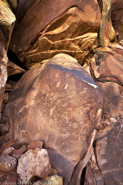
Notch Panel Right by IntrepidXJ, on Flickr
The two large petroglyph panels found here.
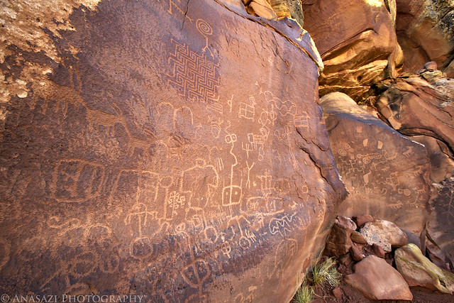
Notch Panels by IntrepidXJ, on Flickr
A spiraled-snake hidden on a boulder.
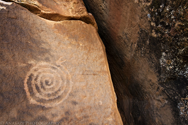
Spiral Snake by IntrepidXJ, on Flickr
This is probably my favorite part of this panel. The large maze-like design is very unique, but the two-headed snake above it is way cool!
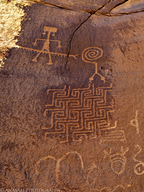
Two-Headed Snake by IntrepidXJ, on Flickr
After visiting the petroglyphs we were on our way towards Paw Hole and the White Pocket.
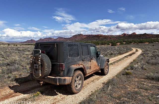
To White Pocket by IntrepidXJ, on Flickr
Follwing the sandy road near some sandstone teepees.
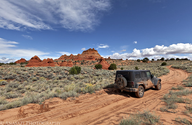
Sandy Road by IntrepidXJ, on Flickr
When we reached the intersection near Poverty Ranch we found a couple with a Dodge Dakota buried in the sand. I decided that I better stop and find out if they needed any help since it's a pretty remote area and we had not seen anyone else out there. After speaking to them we found out that they were on vacation from Switzerland and had rented this 4x4 truck so that they could visit the White Pocket. After we checked to make sure the transfercase was in 4x4 mode we had them try to drive out again. We saw that the front wheels were not spinning at all. Looking underneath the truck, it appeared that they had a broken CV joint which was most likely the problem, since all the power to the front axle would be sent to that side. We talked it over with them and came to the conclusion that they would probably not be able to get to the White Pocket without working four wheel drive. I got my Jeep behind their truck and winched them out of the deep sand an onto some firmer ground where they could turn around. Then we followed them back to the main road, just to make sure they did not get stuck again and that they got out safely. This set us back an hour or so, but it was definitely the right thing to do since they may not have been able to get out of the sand on their own, and it didn't appear that they were prepared to spend the night out there either. It was definitely our good deed done for the day!
Jared took a few photos of me winching the truck out of the sand. Since I rarely have needed to self-recover my Jeep, it was good to make sure the winch still works!
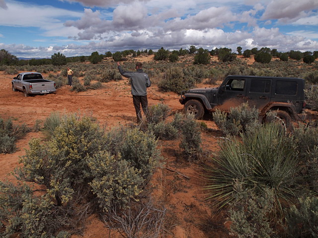
Deep Sand Recovery by xjblue, on Flickr
Winched out of the hole they had dug themselves into.
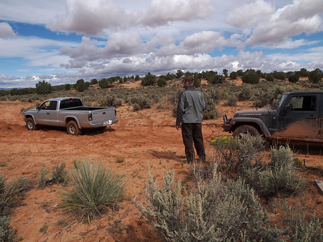
Deep Sand Recovery by xjblue, on Flickr
After making sure the couple was back on a good road, we turned around and continued back towards the White Pocket. We passed this small arch along the way.
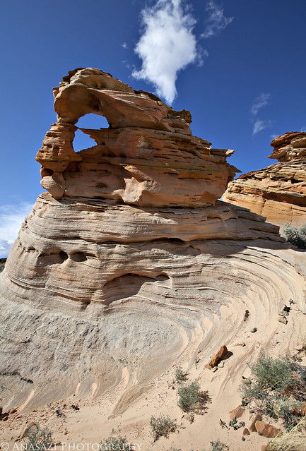
Twisted Arch by IntrepidXJ, on Flickr
Finally we made it to the White Pocket! We grabbed our cameras and hiked the short sandy trail.
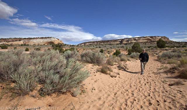
Short Hike to White Pocket by IntrepidXJ, on Flickr
The White Pocket is an awesome place! Jared and I had a lot of fun just exploring this area and taking many photos. We also got lucky with the sky since there were many clouds moving quickly and constantly changing. The only downside was that the wind was blowing very hard the whole time we were there. There were many full potholes and puddles around, but the wind was blowing so hard that none of them were still enough for good reflections. This short visit was a good introduction to the White Pocket area and I'm sure that I'll be returning again in the future! Here are some of my better photos from the few hours we spent there...
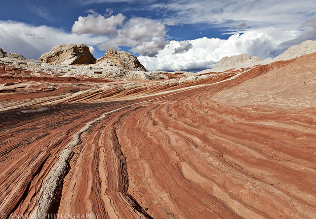
To the Clouds by IntrepidXJ, on Flickr
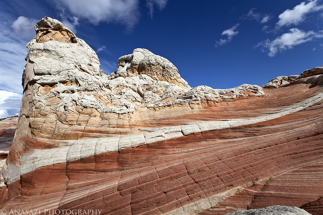
Colors by IntrepidXJ, on Flickr
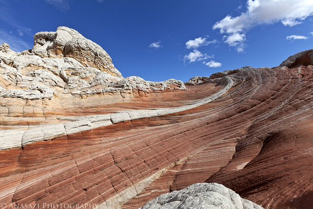
To the Sky by IntrepidXJ, on Flickr
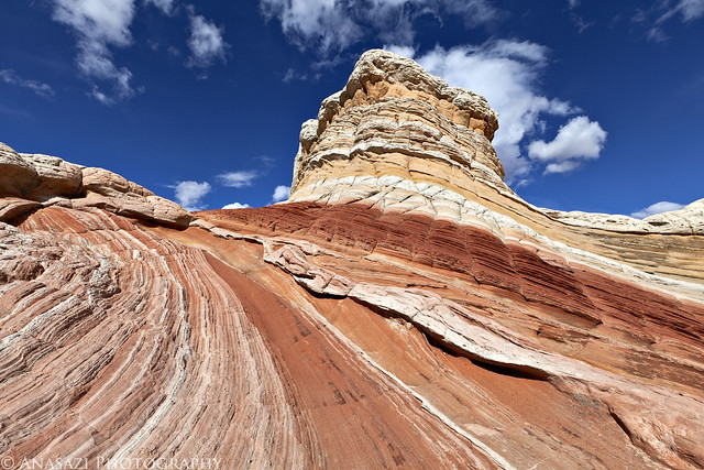
Colorful Butte by IntrepidXJ, on Flickr
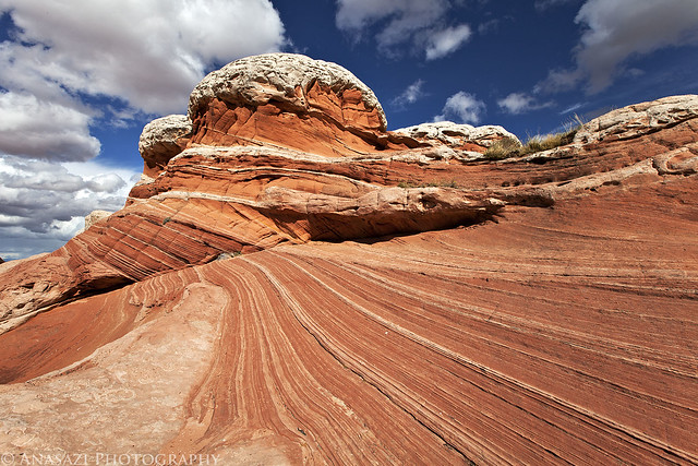
Lines by IntrepidXJ, on Flickr
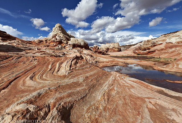
White Pocket Landscape by IntrepidXJ, on Flickr
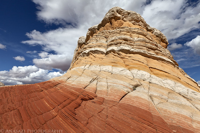
Stripes by IntrepidXJ, on Flickr
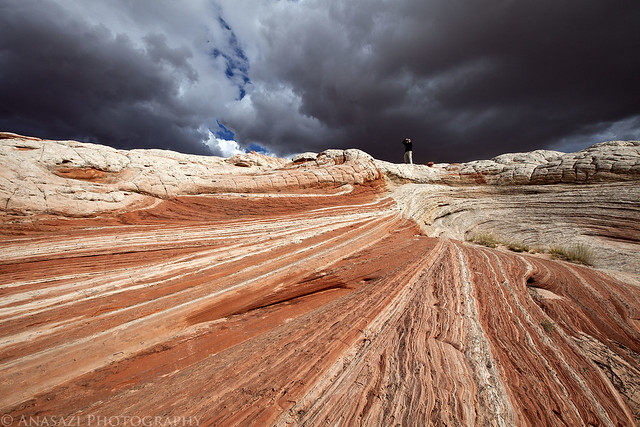
Jared & Storm Clouds by IntrepidXJ, on Flickr
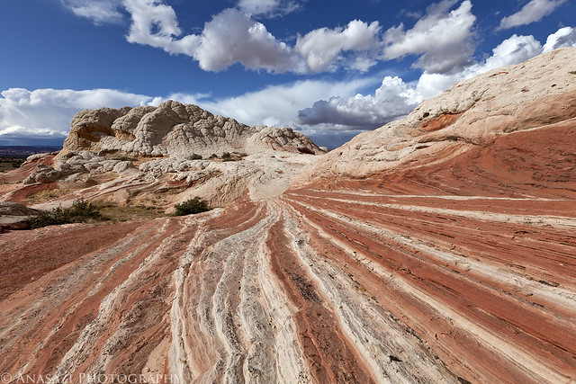
Lines & Clouds Everywhere by IntrepidXJ, on Flickr
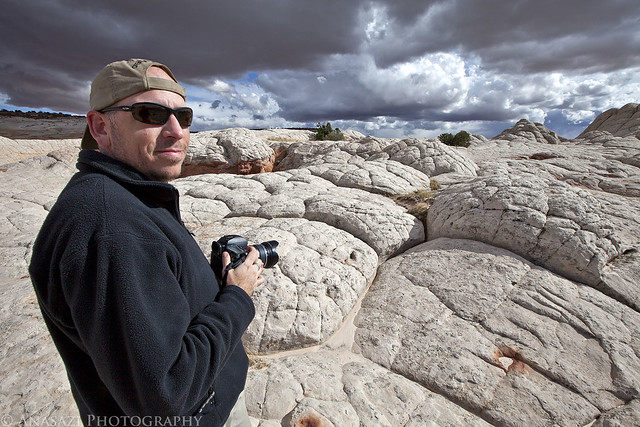
Jared by IntrepidXJ, on Flickr
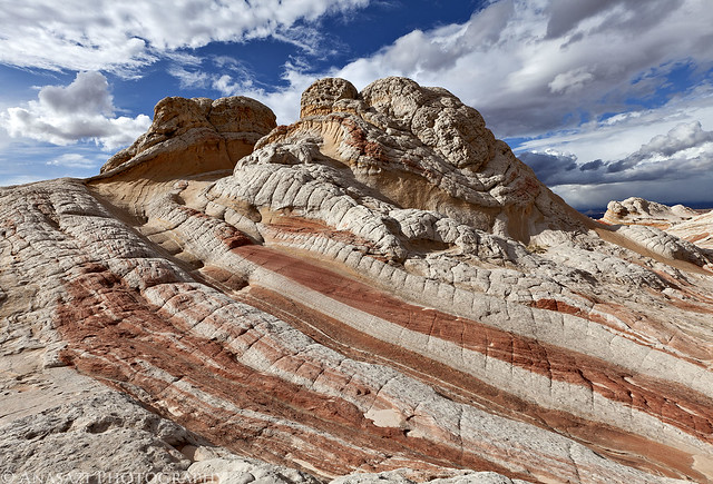
Spiral by IntrepidXJ, on Flickr
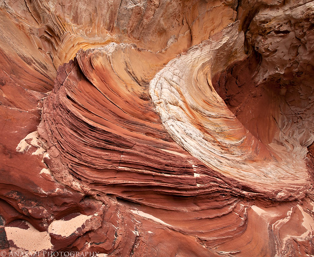
Sandstone Design by IntrepidXJ, on Flickr
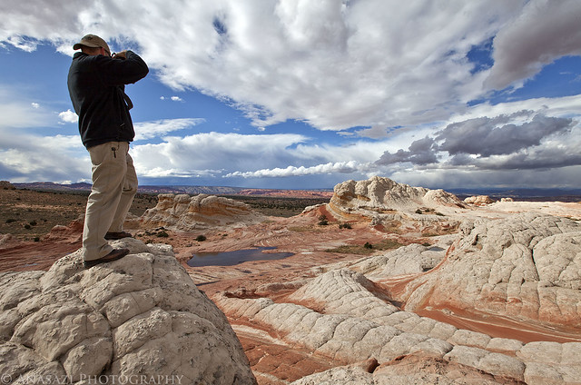
Over the White Pocket by IntrepidXJ, on Flickr
A storm behind us as we head back north into Utah.
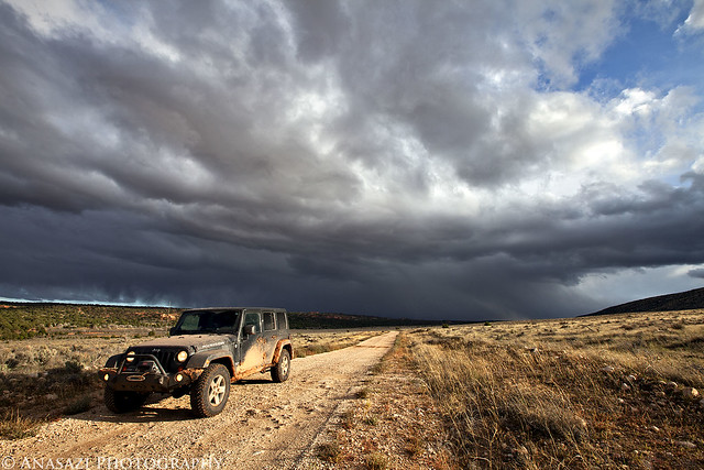
Storm by IntrepidXJ, on Flickr
Driving back on House Rock Valley Road close to sunset.
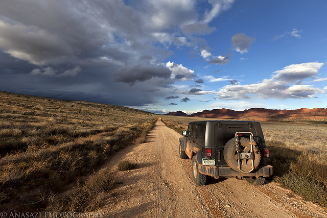
House Rock Valley Road by IntrepidXJ, on Flickr
We drove back through Kanab so we could grab a quick dinner and fuel up the Jeep before turning south again and driving up onto the Kaibab Plateau. We found our way to the trailhead for Snake Gulch and setup camp in the dark. There was a layer of small hail covering the ground when we arrived...it was going to be another cold night!
>> The White Pocket Photo Gallery
Thursday, October 6, 2011
The Original Trip Report on ADVENTR.CO
On Thursday we decided to take things easy again since we had another long hike planned for Friday. We didn't really have any plans for the day, so over breakfast we brainstormed some ideas and decided to head over to the White Pocket for the day. I had not been there before and it was on my long list of places to visit. Plus, since it had rained all night, we thought there might be some nice puddles and full potholes out there.
Shortly after turning onto the House Rock Valley Road on our way south to the White Pocket we came to the Buckskin Wash crossing. The water was high and flowing pretty good. In front of us were some people that were on their way to The Wave in a rental Jeep Liberty. We arrived just in time to watch them floor it and cross the wash with a lot of speed. Apparently they were pretty determined to put their permits to good use that day. They made it across fine and I drove across the wash with ease, putting my transfercase into 4x4 just to be on the safe side.
After crossing the state line into Arizona we parked the Jeep and hiked to the Notch Petroglyph Panel so that we could visit at least one rock art site. This is a view of the right side of the Notch Panel.
Notch Panel Right by IntrepidXJ, on Flickr
The two large petroglyph panels found here.
Notch Panels by IntrepidXJ, on Flickr
A spiraled-snake hidden on a boulder.
Spiral Snake by IntrepidXJ, on Flickr
This is probably my favorite part of this panel. The large maze-like design is very unique, but the two-headed snake above it is way cool!
Two-Headed Snake by IntrepidXJ, on Flickr
After visiting the petroglyphs we were on our way towards Paw Hole and the White Pocket.
To White Pocket by IntrepidXJ, on Flickr
Follwing the sandy road near some sandstone teepees.
Sandy Road by IntrepidXJ, on Flickr
When we reached the intersection near Poverty Ranch we found a couple with a Dodge Dakota buried in the sand. I decided that I better stop and find out if they needed any help since it's a pretty remote area and we had not seen anyone else out there. After speaking to them we found out that they were on vacation from Switzerland and had rented this 4x4 truck so that they could visit the White Pocket. After we checked to make sure the transfercase was in 4x4 mode we had them try to drive out again. We saw that the front wheels were not spinning at all. Looking underneath the truck, it appeared that they had a broken CV joint which was most likely the problem, since all the power to the front axle would be sent to that side. We talked it over with them and came to the conclusion that they would probably not be able to get to the White Pocket without working four wheel drive. I got my Jeep behind their truck and winched them out of the deep sand an onto some firmer ground where they could turn around. Then we followed them back to the main road, just to make sure they did not get stuck again and that they got out safely. This set us back an hour or so, but it was definitely the right thing to do since they may not have been able to get out of the sand on their own, and it didn't appear that they were prepared to spend the night out there either. It was definitely our good deed done for the day!
Jared took a few photos of me winching the truck out of the sand. Since I rarely have needed to self-recover my Jeep, it was good to make sure the winch still works!
Deep Sand Recovery by xjblue, on Flickr
Winched out of the hole they had dug themselves into.
Deep Sand Recovery by xjblue, on Flickr
After making sure the couple was back on a good road, we turned around and continued back towards the White Pocket. We passed this small arch along the way.
Twisted Arch by IntrepidXJ, on Flickr
Finally we made it to the White Pocket! We grabbed our cameras and hiked the short sandy trail.
Short Hike to White Pocket by IntrepidXJ, on Flickr
The White Pocket is an awesome place! Jared and I had a lot of fun just exploring this area and taking many photos. We also got lucky with the sky since there were many clouds moving quickly and constantly changing. The only downside was that the wind was blowing very hard the whole time we were there. There were many full potholes and puddles around, but the wind was blowing so hard that none of them were still enough for good reflections. This short visit was a good introduction to the White Pocket area and I'm sure that I'll be returning again in the future! Here are some of my better photos from the few hours we spent there...
To the Clouds by IntrepidXJ, on Flickr
Colors by IntrepidXJ, on Flickr
To the Sky by IntrepidXJ, on Flickr
Colorful Butte by IntrepidXJ, on Flickr
Lines by IntrepidXJ, on Flickr
White Pocket Landscape by IntrepidXJ, on Flickr
Stripes by IntrepidXJ, on Flickr
Jared & Storm Clouds by IntrepidXJ, on Flickr
Lines & Clouds Everywhere by IntrepidXJ, on Flickr
Jared by IntrepidXJ, on Flickr
Spiral by IntrepidXJ, on Flickr
Sandstone Design by IntrepidXJ, on Flickr
Over the White Pocket by IntrepidXJ, on Flickr
A storm behind us as we head back north into Utah.
Storm by IntrepidXJ, on Flickr
Driving back on House Rock Valley Road close to sunset.
House Rock Valley Road by IntrepidXJ, on Flickr
We drove back through Kanab so we could grab a quick dinner and fuel up the Jeep before turning south again and driving up onto the Kaibab Plateau. We found our way to the trailhead for Snake Gulch and setup camp in the dark. There was a layer of small hail covering the ground when we arrived...it was going to be another cold night!
>> The White Pocket Photo Gallery