Keyhole Canyon, Southern Nevada
 10-24-2008, 09:14 PM
#1
JK Newbie
Thread Starter
Join Date: Oct 2007
Location: Boulder City, Nevada
Posts: 93
Likes: 0
Received 0 Likes
on
0 Posts
Keyhole Canyon is a Miocene granite outcrop located in the Eldorado Mountains and is visible from US 95.
There are no fees and no hours of use for the area.
There is no official camping area, although you will see the remnants of campfires.
This area is also used by rock climbers.
Getting there:
When traveling south on US Highway 95 heading towards Searchlight Nevada, and once you have passed the Nelson cutoff, start watching for mile marker 41. At approximately .6 (6 tenths) of a mile past (south of) mile marker 41, on your left as you are heading south (east side of the road), you will see a white metal cattle guard. Turn left (east) at the cattle guard. Note: This is apparently a well used off-road area because there is a left-turn lane on the southbound side of Hwy 95 so that you do not have to cross the median illegally.
If you are traveling north on Hwy 95 from Searchlight, watch for mile marker 40, and approximately .4 (4 tenths) of a mile past (north of) mile marker 40 on your right (east side of the road) you will see the white metal cattle guard. Here you will turn right and head east.
Cross over the cattle guard heading east on the dirt road. You well see a set of 3 high voltage towers approximately 2.0 miles ahead of you. Cross under the first set of high voltage lines and continue heading towards the second set. Between the second and third towers you will see another dirt road. Turn right (south) on that dirt road. In approximately 1.7 miles you will see tower number 23E3 on your left. About 50' beyond the tower is a road going to your left and straight towards Keyhole Canyon. Follow that road a short distance to the parking area.
This is not really a trail but a neat place none the less.
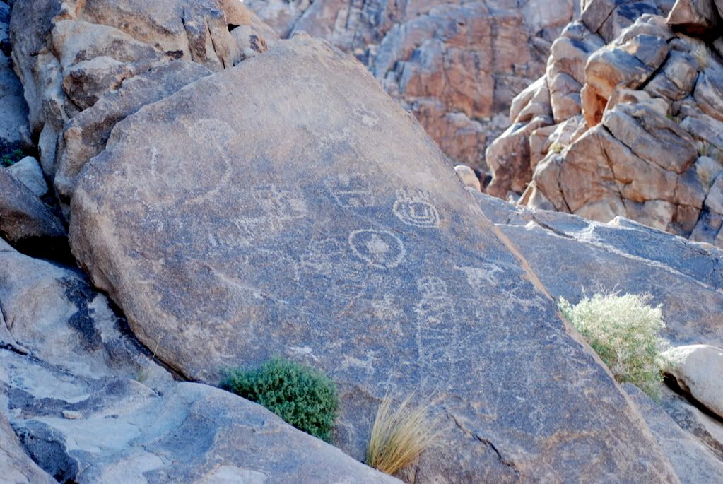
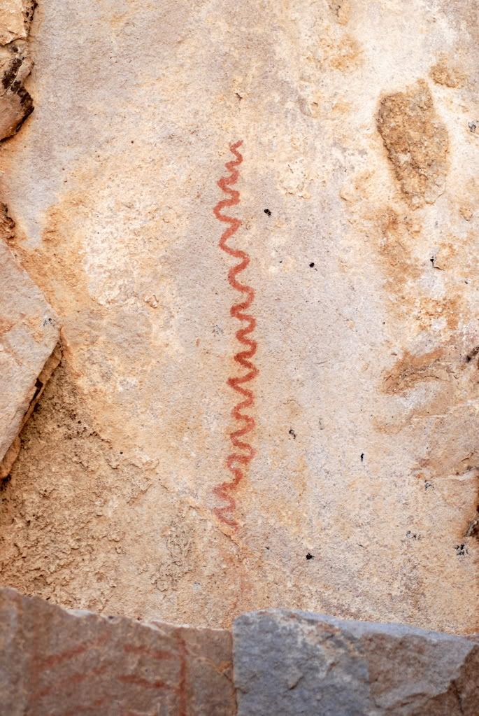
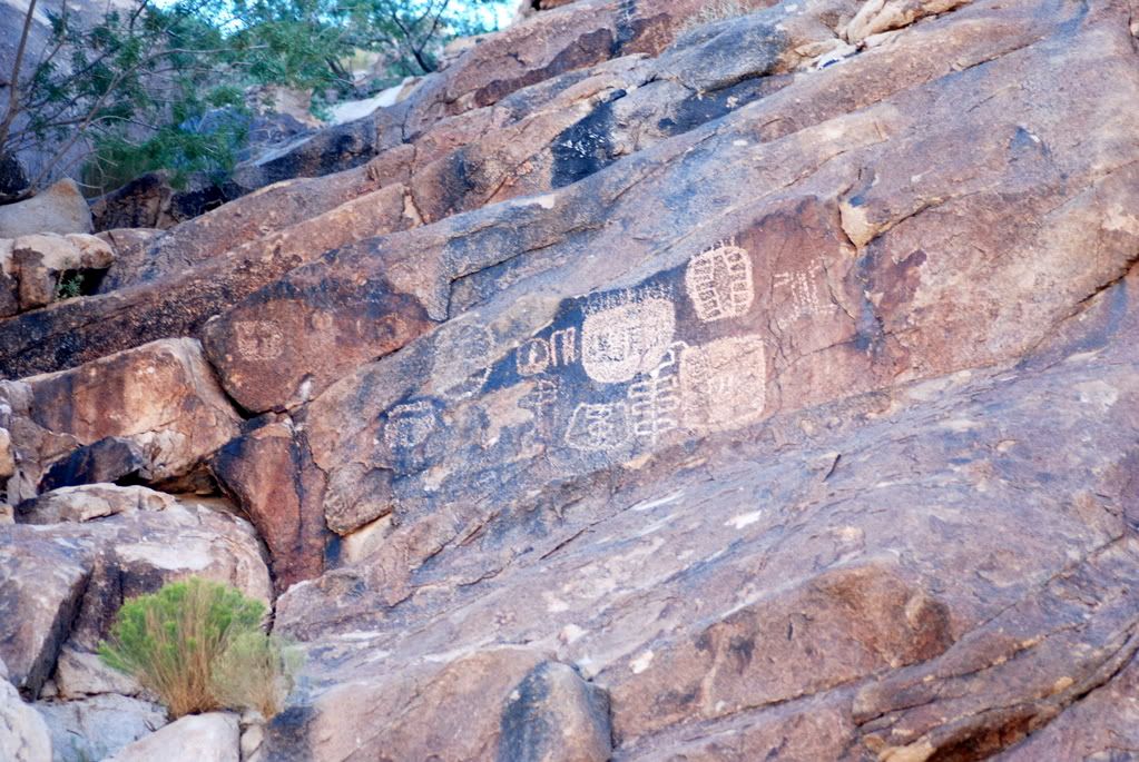
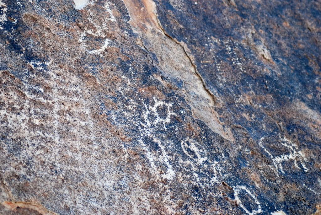
The petroglyphs are concentrated at the entrance of the canyon, but also extend to the left and right of the canyon mouth. Look up high and at eye level - they are everywhere. The longer you look the more you will see.
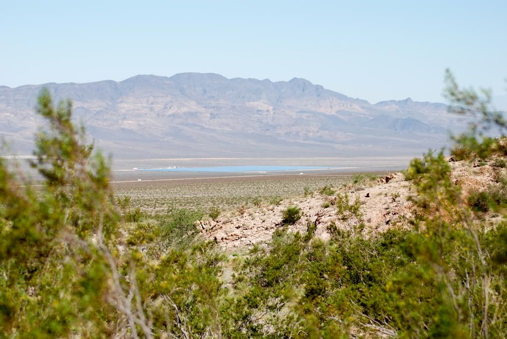
Looking back toward US 95 and the solar plant
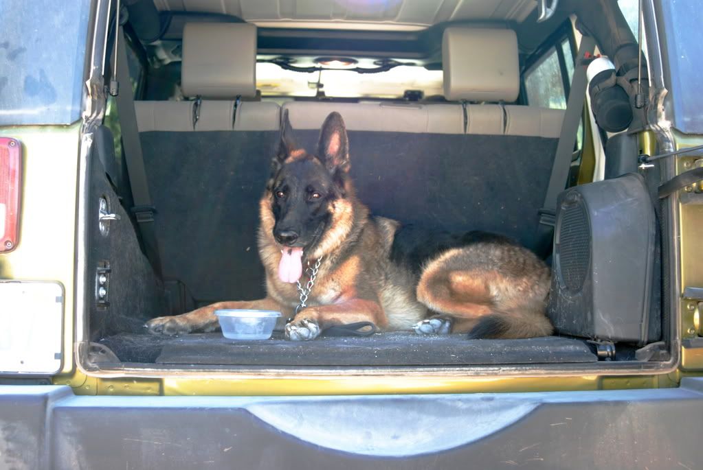
This was a very hot Southern Nevada summer day, and Sarg was ready to go home.
There are no fees and no hours of use for the area.
There is no official camping area, although you will see the remnants of campfires.
This area is also used by rock climbers.
Getting there:
When traveling south on US Highway 95 heading towards Searchlight Nevada, and once you have passed the Nelson cutoff, start watching for mile marker 41. At approximately .6 (6 tenths) of a mile past (south of) mile marker 41, on your left as you are heading south (east side of the road), you will see a white metal cattle guard. Turn left (east) at the cattle guard. Note: This is apparently a well used off-road area because there is a left-turn lane on the southbound side of Hwy 95 so that you do not have to cross the median illegally.
If you are traveling north on Hwy 95 from Searchlight, watch for mile marker 40, and approximately .4 (4 tenths) of a mile past (north of) mile marker 40 on your right (east side of the road) you will see the white metal cattle guard. Here you will turn right and head east.
Cross over the cattle guard heading east on the dirt road. You well see a set of 3 high voltage towers approximately 2.0 miles ahead of you. Cross under the first set of high voltage lines and continue heading towards the second set. Between the second and third towers you will see another dirt road. Turn right (south) on that dirt road. In approximately 1.7 miles you will see tower number 23E3 on your left. About 50' beyond the tower is a road going to your left and straight towards Keyhole Canyon. Follow that road a short distance to the parking area.
This is not really a trail but a neat place none the less.
The petroglyphs are concentrated at the entrance of the canyon, but also extend to the left and right of the canyon mouth. Look up high and at eye level - they are everywhere. The longer you look the more you will see.
Looking back toward US 95 and the solar plant
This was a very hot Southern Nevada summer day, and Sarg was ready to go home.


