


New Mexico trail coordinates


Thread Starter
JK Newbie
Joined: Jun 2009
Posts: 49
Likes: 0
From: Netherlands
 New Mexico trail coordinates
Does someone know if the trails , The Joker , Rattlesnake , coyote canyon , the Gauntlet and Three Amigos in Tularosa still are open.
If u can help me on the coordinates that would be perfect,
Thx,
Marc,
If u can help me on the coordinates that would be perfect,
Thx,
Marc,

JK Super Freak

Joined: Apr 2007
Posts: 1,258
Likes: 1
From: Prosper, TX
JK Newbie
Joined: May 2007
Posts: 75
Likes: 1
From: Grand Prairie, TX
I moved from Las Cruces last year, and I really miss all trails out there. Anyway, I went through some of my old bookmarks and came across the this website. Not sure how up-to-date it is, but you might try contacting them for coordinates or directions to those trails. http://www.zianet.com/dm4wd/trails.html
Trending Topics
JK Super Freak
Joined: Mar 2009
Posts: 1,529
Likes: 1
From: Austin, TX
Are they part of this? 
http://www.yotatech.com/f100/vermejo...71/index4.html
Looks pretty hardcore to me!
http://www.yotatech.com/f100/vermejo...71/index4.html
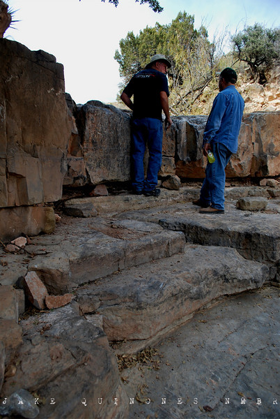
The Robledo Mountains Off-Highway Vehicle Trail System is a network of trails, including both extreme OHV and mountain bike trails, in the southern Robledo Mountains. The trails are dominated by enormous rocks, making the terrain extraordinarily challenging for riders. The extreme OHV trails require specialized vehicles, with locking differentials, winches, and expert drivers. Vehicle damage is not uncommon on these very difficult OHV trails.
The area also includes the "SST" mountain bike trail, which is open only to non-motorized uses. It also is an extremely technical trail -- traversing challenging rocky terrain, steep canyons, and mountain-top ridges -- and requires expert riding skills.
Activities
Off-highway vehicle use (rock crawling; extreme four-wheel drive trails), mountain biking.
Location / Access
The Robledo Mountains OHV Area and SST Trail are in the Robledo Mountains about four miles northwest of Las Cruces. Take Valley Drive (U.S. 85) north to Shalem Colony Trail, go west on Shalem Colony Trail across the Rio Grande, turn right on Rocky Acres Trail, and take the first left off the wide dirt road. You will see signs for extreme four-wheel drive trails south of the main road; trails north of that road have been closed. The main road goes west toward a rock mine; take the left fork in the arroyo bottom, climb the hill, and go right up the canyon bottom to find the mountain bike trail and additional extreme four-wheel drive routes.
USGS: Dona Ana, Las Cruces, Leasburg, and Picacho Mountain
Source-BLM.gov
More pics at New Mexico Backroads
Amatista Ledges I - LINK
Amatista Ledges II - LINK
This area is currently at risk for closure to all motorized vehicles. For more info - Click Here
The area also includes the "SST" mountain bike trail, which is open only to non-motorized uses. It also is an extremely technical trail -- traversing challenging rocky terrain, steep canyons, and mountain-top ridges -- and requires expert riding skills.
Activities
Off-highway vehicle use (rock crawling; extreme four-wheel drive trails), mountain biking.
Location / Access
The Robledo Mountains OHV Area and SST Trail are in the Robledo Mountains about four miles northwest of Las Cruces. Take Valley Drive (U.S. 85) north to Shalem Colony Trail, go west on Shalem Colony Trail across the Rio Grande, turn right on Rocky Acres Trail, and take the first left off the wide dirt road. You will see signs for extreme four-wheel drive trails south of the main road; trails north of that road have been closed. The main road goes west toward a rock mine; take the left fork in the arroyo bottom, climb the hill, and go right up the canyon bottom to find the mountain bike trail and additional extreme four-wheel drive routes.
USGS: Dona Ana, Las Cruces, Leasburg, and Picacho Mountain
Source-BLM.gov
More pics at New Mexico Backroads
Amatista Ledges I - LINK
Amatista Ledges II - LINK
This area is currently at risk for closure to all motorized vehicles. For more info - Click Here
Last edited by JK-Tex; Mar 26, 2012 at 03:22 AM.
JK Super Freak
Joined: Apr 2007
Posts: 1,258
Likes: 1
From: Prosper, TX
Are they part of this?
http://www.yotatech.com/f100/vermejo...71/index4.html
Looks pretty hardcore to me!
http://www.yotatech.com/f100/vermejo...71/index4.html
Looks pretty hardcore to me!
