
Smokey Mountains

Thread Starter
JK Super Freak
Joined: Oct 2008
Posts: 1,415
Likes: 0
From: Sussex County, NJ
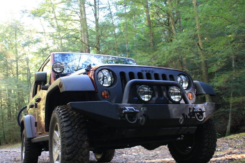
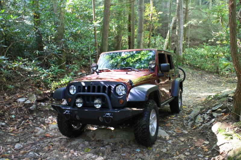
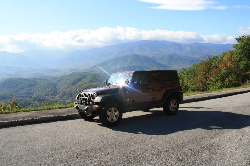
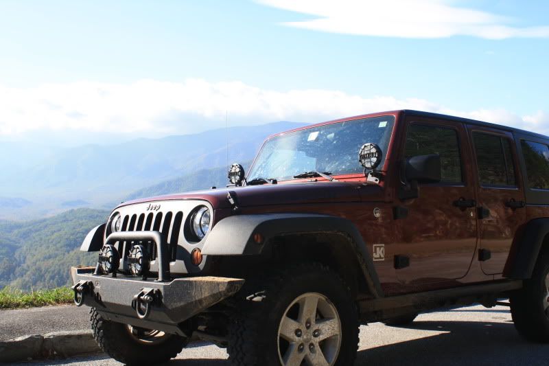
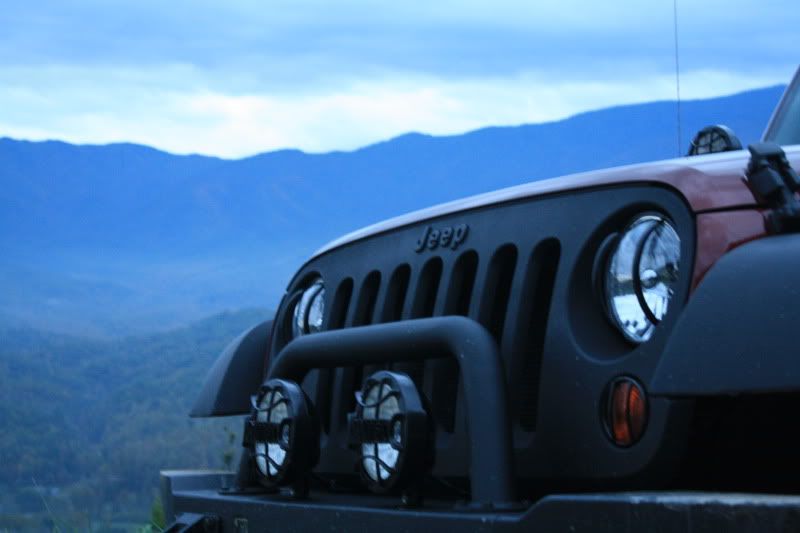
Just got back from the Great Smokies in TN and thought i'd share a few pics...
I had a hard time finding any trails before I left so here is what I found when I got there...
Horse Creek Recreation Area- Forest Road 94 is unpaved and has a few stream crossings and some moderate rocks. Overall I thought this was a very good trail. About 4.5 miles each way and at the end it overlooks the mountains. Took me about 4 hours round trip with some stopping. With 2" of lift and stock Rubi tires I nearly hit my diff a couple times. It was a good time tho...
Cherokee Medow Creek (Cocke County, TN) is a gravel road up hill to a look out tower with nice views. Road is just gravel
Green Brier Road (past the Greenbrier ranger station) turns into an unpaved gravel road. Nothing difficult, but it goes over a few bridges with nice views of Little Pigeon River and ends up at some decent hiking trails
There are more, but the best advise I have is to visit the Great Smokey Mountain visitors center and pick up the auto touring map...it shows the unpaved roads.
Here are some pics...


[IMG]http://i51.photobucket.com/albums/f396/jmat1980/TN%20Trip/IMG_0150
.jpg[/IMG]'


I had a hard time finding any trails before I left so here is what I found when I got there...
Horse Creek Recreation Area- Forest Road 94 is unpaved and has a few stream crossings and some moderate rocks. Overall I thought this was a very good trail. About 4.5 miles each way and at the end it overlooks the mountains. Took me about 4 hours round trip with some stopping. With 2" of lift and stock Rubi tires I nearly hit my diff a couple times. It was a good time tho...
Cherokee Medow Creek (Cocke County, TN) is a gravel road up hill to a look out tower with nice views. Road is just gravel
Green Brier Road (past the Greenbrier ranger station) turns into an unpaved gravel road. Nothing difficult, but it goes over a few bridges with nice views of Little Pigeon River and ends up at some decent hiking trails
There are more, but the best advise I have is to visit the Great Smokey Mountain visitors center and pick up the auto touring map...it shows the unpaved roads.
Here are some pics...
[IMG]http://i51.photobucket.com/albums/f396/jmat1980/TN%20Trip/IMG_0150
.jpg[/IMG]'
JK Freak
Joined: Sep 2008
Posts: 566
Likes: 2
From: Nasvhille, Tennessee
I know I posted in your other post in jeeps in beatiful places, but I'm really excited. I've yet to here of any unpaved areas to check out. Gonna go check these places out very soon. Thanks for posting them. I just moved to the smoky's about 3 months ago and have no regrets. such a beautiful place! 
-chad-
-chad-
Thread Starter
JK Super Freak
Joined: Oct 2008
Posts: 1,415
Likes: 0
From: Sussex County, NJ
I know I posted in your other post in jeeps in beatiful places, but I'm really excited. I've yet to here of any unpaved areas to check out. Gonna go check these places out very soon. Thanks for posting them. I just moved to the smoky's about 3 months ago and have no regrets. such a beautiful place!
-chad-
-chad-
JK Enthusiast
Joined: Apr 2009
Posts: 226
Likes: 0
From: Johnson City, TN
Nice pics Jmat1980  Next time im down in g-burg area I'll definitely be picking up one of those maps and checking out the back country a bit. Glad to see that you had a good time in the smokies.
Next time im down in g-burg area I'll definitely be picking up one of those maps and checking out the back country a bit. Glad to see that you had a good time in the smokies.
Trending Topics
Thread Starter
JK Super Freak
Joined: Oct 2008
Posts: 1,415
Likes: 0
From: Sussex County, NJ
A few people PMd me about the Horse Creek Park Recreation Area Trail, so here are some better directions:
Horse Creek Park Recreation Area is in the Cherokee National Forest. If you have a GPS, put in the intersection of Rt 107 and Horse Creek Park Road in Greeneville, TN. Once you get on Horse Creek Park Road follow the signs for the campground. Once you enter the Recreation Area there is a sign for the camground pointing to the right. You will stay straight and it will turn into forest road 94. Forest Road 94 is unpaved and starts out mild. There are several stream crossings and before long the road will get pretty bumpy, lots of rocks, streams, etc... I think it eventually turns to forest road 88?? But there are no further signs after the pavement ends. The trail goes for approximately 4 miles and ends at a high elevation with a lookout with good views. The only part that sux is that it is not a loop, you have to go out the way you came in. I thought the ride out was more difficult... It took me about 4 hrs round trip with several stops.
Have fun out there
 GOOD LOOKING JEEP