


los coyotes canyon sunday 4/12 supposed to be some good stuff


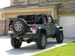

JK Freak

Joined: May 2008
Posts: 744
Likes: 1
From: Escondido, CA
 Last Run
Around 2005, when the Tribe closed the reservation to off-roading, it cost $20 a day to run their trails. They used to collect the fee at the main gate. Is that still the case? Did you take the trail to the top of Hot Springs Mountain? It is the highest spot in San Diego County, about 6.500' as I remember. There is an old abandon fire spotting tower there. The only trails I can remember are "The Squeeze," "Left Turn Hill," which caused a good deal of damage if you didn't turn at the correct time (there were four 90 degree left turns) and there was a trail that ran up or down a series of water falls which were frequently wet in the winter and spring. They also used to have a campground where you could stay over night. Are all of these trails/places open?

JK Freak
Joined: Feb 2012
Posts: 686
Likes: 1
From: La Quinta California

Around 2005, when the Tribe closed the reservation to off-roading, it cost $20 a day to run their trails. They used to collect the fee at the main gate. Is that still the case? Did you take the trail to the top of Hot Springs Mountain? It is the highest spot in San Diego County, about 6.500' as I remember. There is an old abandon fire spotting tower there. The only trails I can remember are "The Squeeze," "Left Turn Hill," which caused a good deal of damage if you didn't turn at the correct time (there were four 90 degree left turns) and there was a trail that ran up or down a series of water falls which were frequently wet in the winter and spring. They also used to have a campground where you could stay over night. Are all of these trails/places open?
JK Freak
Joined: May 2008
Posts: 744
Likes: 1
From: Escondido, CA
The Good Old Days
Your " big old V-notch" sounds like the enterance to "the Squeeze" of my days. To exit you had to make a 90 degree left at the bottom and then climb three foot vertical rock wall to leave. Sound familiar? They used to give you a map of the trails around the reservation at the Main Gate. Do they still do that?
DF
DF
Trending Topics
JK Freak
Joined: Feb 2012
Posts: 686
Likes: 1
From: La Quinta California
Your " big old V-notch" sounds like the enterance to "the Squeeze" of my days. To exit you had to make a 90 degree left at the bottom and then climb three foot vertical rock wall to leave. Sound familiar? They used to give you a map of the trails around the reservation at the Main Gate. Do they still do that?
DF
DF
Bad pictures but this is the part I am talking about.


Last edited by 4x4chick; Apr 13, 2015 at 01:23 PM.
JK Freak
Joined: May 2008
Posts: 744
Likes: 1
From: Escondido, CA
Yesterdays
Your photo shows what we used to call "the Squeeze." I found a lot of photos on line at:
http://www.dirtopia.com/wiki/Los_Coy...n_Reservation/
Photos of most of the trails from 1996 - 2002 taken by the "Spinnin Fours" 4X4 club. I don't know where they are out of. They have several photos of a trail called "El Hill" which I remember well. All-in all, Los Coyotes used to have some of the nastiest trails in SD County. 4X4 clubs would come from other states just to run them. I'm glad to hear & see that the Reservation in once again open to 4X4's. The magic formula was: 35's + 4.56 R&P gears + lockers front and rear + 4:1 "T" case + a final crawl ratio of around 80:1 would make the trails at Los Coyotes a Sunday drive. Anything less would increase the pucker factor proportionally. In any case - expect body damage. DF
http://www.dirtopia.com/wiki/Los_Coy...n_Reservation/
Photos of most of the trails from 1996 - 2002 taken by the "Spinnin Fours" 4X4 club. I don't know where they are out of. They have several photos of a trail called "El Hill" which I remember well. All-in all, Los Coyotes used to have some of the nastiest trails in SD County. 4X4 clubs would come from other states just to run them. I'm glad to hear & see that the Reservation in once again open to 4X4's. The magic formula was: 35's + 4.56 R&P gears + lockers front and rear + 4:1 "T" case + a final crawl ratio of around 80:1 would make the trails at Los Coyotes a Sunday drive. Anything less would increase the pucker factor proportionally. In any case - expect body damage. DF
Last edited by Desert Fox; Apr 13, 2015 at 03:14 PM.