Arkansas Riders
 01-26-2012, 11:41 AM
#21
JK Junkie
Sorry so late on response. But if any of you guys are near Ouachita National Forest, this is just about as good as it gets for Arkansas. Beautiful valley trails that travel besides flowing streams ( Brown Creek Rd ). Gourges mountain vistas ( Ouachita National Forest Auto Tour ). Deep woods scenery ( No cell phone service ). Miles and miles of trails.
For those of you near Lake Maumelle are. Go west on Hwy 10 past Maumelle lake. Continue straight ahead ( west ? ) on Hwy 9 / 10 till you see the sign for "Lake Sylvia". Turn left ( Hwy324 ) towards Lk Sylvia. The second right should be Browns Creek Rd. Stay on this dirt road till you get to the "Shoe Tree" ( tree with shoes in it ). Turn left at the tree. This trail will lead you to Hwy 7 ( eventually ). You will see a beautiful pointed mountain in front of you. Lots of climbers seem to know wher this spot is. When you get to Hwy 7, turn left. About 2 miles, you should see another sign for Lake Winona Rd. Turn left there. This road will lead you back to Hwy 9 past Lk Winona. Round trip is about 1.5 hrs. Turn back left again on Hwy 9 to get back to Hwy 10.
On your way back to Hwy 10, you will see another sign "Ouachita National Forest Auto Tour". This trail will lead you through beautiful mountain vistas with overlooks.
Everyone have fun and be safe.
Last edited by JK-Ford; 01-27-2012 at 01:26 AM.
 01-26-2012, 11:46 AM
#22

Sorry so late on response. But if any of you guys are near Ouachita National Forest, this is just about as good as it gets for Arkansas. Beautiful valley trails that travel besides flowing streams ( Bear Creek Rd ). Gourges mountain vistas ( Ouachita National Forest Auto Tour ). Deep woods scenery ( No cell phone service ). Miles and miles of trails.
For those of you near Lake Maumelle are. Go west on Hwy 10 past Maumelle lake. Continue straight ahead ( west ? ) on Hwy 9 / 10 till you see the sign for "Lake Sylvia". Turn left ( Hwy324 ) towards Lk Sylvia. The second right should be Browns Creek Rd. Stay on this dirt road till you get to the "Shoe Tree" ( tree with shoes in it ). Turn left at the tree. This trail will lead you to Hwy 7 ( eventually ). You will see a beautiful pointed mountain in front of you. Lots of climbers seem to know wher this spot is. When you get to Hwy 7, turn left. About 2 miles, you should see another sign for Lake Winona Rd. Turn left there. This road will lead you back to Hwy 9 past Lk Winona. Round trip is about 1.5 hrs. Turn back left again on Hwy 9 to get back to Hwy 10.
On your way back to Hwy 10, you will see another sign "Ouachita National Forest Auto Tour". This trail will lead you through beautiful mountain vistas with overlooks.
Everyone have fun and be safe.
01-27-2012, 01:23 AM
#23
JK Junkie
Frome Conway, take Hwy 60 west accross the river at Toad Suck park. You could stay on Hwy 60 west and go through Huston on your way to Perryville. Then take Hwy 9 / 10 south from Perryville. But the more scenic route will have you turn off of Hwy 60, on to Hwy 113 towards Bigelow and Wye Mountain. This route will provide vistas of Lake Maumelle in the distance. Take a right on Hwy 10 when you arrive at that intersection. Then you will be back on track with my previous directions.
Some of the roads that I mentioned earlier are listed on the map as "Unimproved County Roads" ( Brown Creek Rd. ). And supprising to me, you will see some residences along the first couple of miles. But after that, you will find that "Unimproved" is an understatement. Most of the other roads are listed on the map as " Forest Trail Number ####". Some of these trails are actually better than the county roads. And then again, some will give your suspension ( and your back side ) a serious work-out. I would estimate that the difficulty rating of the route previously described would be mostly 0-1 with a small section of 2's hear and there. There is 1 decent mountain climb that consists of a couple switchbacks. There are numerous other finger trails along the way with ratings that are to dificult for me to go alone. And there is a completely different section of forrest on the west side of Hwy 7 that I have yet to explore. I believe that some of the guys have made comments on this section of the woods in the "AAA Group Forum".
I know that shop has an excellent reputation. And their prices have been comparable to anyone elses. I did stop in and talked with the owner of the new shop in NLR ( McCain Area ). And you could tell that this guy was good. But he is to new to have established a reputation. Either way, I'm a DIY kinda guy.
Some of the roads that I mentioned earlier are listed on the map as "Unimproved County Roads" ( Brown Creek Rd. ). And supprising to me, you will see some residences along the first couple of miles. But after that, you will find that "Unimproved" is an understatement.
Most of the other roads are listed on the map as " Forest Trail Number ####". Some of these trails are actually better than the county roads. And then again, some will give your suspension ( and your back side ) a serious work-out. I would estimate that the difficulty rating of the route previously described would be mostly 0-1 with a small section of 2's hear and there. There is 1 decent mountain climb that consists of a couple switchbacks. There are numerous other finger trails along the way with ratings that are to dificult for me to go alone. And there is a completely different section of forrest on the west side of Hwy 7 that I have yet to explore. I believe that some of the guys have made comments on this section of the woods in the "AAA Group Forum". I know that shop has an excellent reputation. And their prices have been comparable to anyone elses. I did stop in and talked with the owner of the new shop in NLR ( McCain Area ). And you could tell that this guy was good. But he is to new to have established a reputation. Either way, I'm a DIY kinda guy.
01-27-2012, 05:00 AM
#24
Frome Conway, take Hwy 60 west accross the river at Toad Suck park. You could stay on Hwy 60 west and go through Huston on your way to Perryville. Then take Hwy 9 / 10 south from Perryville. But the more scenic route will have you turn off of Hwy 60, on to Hwy 113 towards Bigelow and Wye Mountain. This route will provide vistas of Lake Maumelle in the distance. Take a right on Hwy 10 when you arrive at that intersection. Then you will be back on track with my previous directions.
Some of the roads that I mentioned earlier are listed on the map as "Unimproved County Roads" ( Brown Creek Rd. ). And supprising to me, you will see some residences along the first couple of miles. But after that, you will find that "Unimproved" is an understatement. Most of the other roads are listed on the map as " Forest Trail Number ####". Some of these trails are actually better than the county roads. And then again, some will give your suspension ( and your back side ) a serious work-out. I would estimate that the difficulty rating of the route previously described would be mostly 0-1 with a small section of 2's hear and there. There is 1 decent mountain climb that consists of a couple switchbacks. There are numerous other finger trails along the way with ratings that are to dificult for me to go alone. And there is a completely different section of forrest on the west side of Hwy 7 that I have yet to explore. I believe that some of the guys have made comments on this section of the woods in the "AAA Group Forum".
I know that shop has an excellent reputation. And their prices have been comparable to anyone elses. I did stop in and talked with the owner of the new shop in NLR ( McCain Area ). And you could tell that this guy was good. But he is to new to have established a reputation. Either way, I'm a DIY kinda guy.
Some of the roads that I mentioned earlier are listed on the map as "Unimproved County Roads" ( Brown Creek Rd. ). And supprising to me, you will see some residences along the first couple of miles. But after that, you will find that "Unimproved" is an understatement.
Most of the other roads are listed on the map as " Forest Trail Number ####". Some of these trails are actually better than the county roads. And then again, some will give your suspension ( and your back side ) a serious work-out. I would estimate that the difficulty rating of the route previously described would be mostly 0-1 with a small section of 2's hear and there. There is 1 decent mountain climb that consists of a couple switchbacks. There are numerous other finger trails along the way with ratings that are to dificult for me to go alone. And there is a completely different section of forrest on the west side of Hwy 7 that I have yet to explore. I believe that some of the guys have made comments on this section of the woods in the "AAA Group Forum". I know that shop has an excellent reputation. And their prices have been comparable to anyone elses. I did stop in and talked with the owner of the new shop in NLR ( McCain Area ). And you could tell that this guy was good. But he is to new to have established a reputation. Either way, I'm a DIY kinda guy.
I wish I could be more DIY - but its hard since I live in an apartment. I could go use my parents garage, but they live in the sw corner of the state.
01-27-2012, 07:44 AM
#25
JK Junkie
I think I know where that is - sort of on the way to Toad Suck Bucks. I'm going to try and hit that up today - I'm only working til noon.
I wish I could be more DIY - but its hard since I live in an apartment. I could go use my parents garage, but they live in the sw corner of the state.
I wish I could be more DIY - but its hard since I live in an apartment. I could go use my parents garage, but they live in the sw corner of the state.
01-30-2012, 10:16 PM
#26
JK Enthusiast
Join Date: Sep 2007
Location: Arkansas
Posts: 406
Likes: 0
Received 0 Likes
on
0 Posts
Whats up HOG fans, I'm in Little Rock. Been going to the Superlift Park since it opened. Used to ride the trails on Alexander Mountain before they built a neighborhood up there. I am interested in doing the scenic trails JKFord is talking about. Also interested in hitting the Ouachita Highline trail. Not sure if thats the same trail as the "wynona trail" being described. If anyone wants to go riding sometime hit me up.
02-03-2012, 05:22 AM
#27
JK Newbie

Join Date: Jan 2012
Location: Hot Springs, AR
Posts: 99
Likes: 0
Received 0 Likes
on
0 Posts
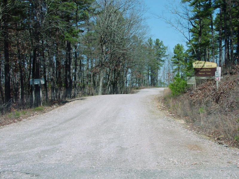
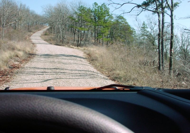
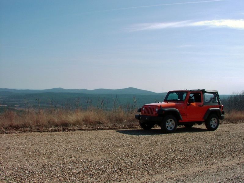
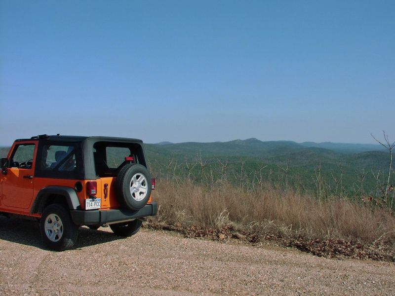
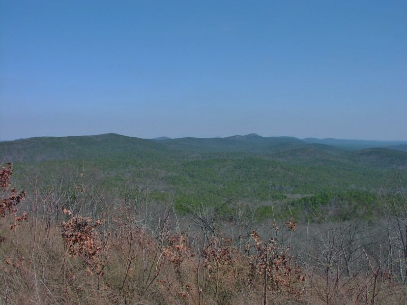
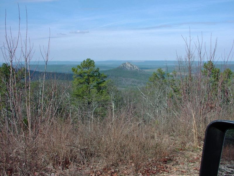
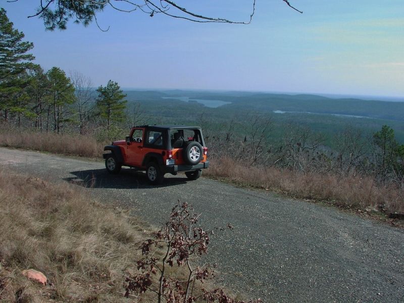
I drove the Winona Scenic Trail for the first time yesterday. It's a very easy drive for a Jeep because it's a well graded dirt road. You could probably make it in a Cadillac, lol. It was a nice day and I took a few pictures. I only saw one other vehicle along the whole 25 miles. Had to clean a bunch of silty dust out of the cabin afterward. Maybe I should have put the top down all the way instead of the sunrider flipped back with the rear window removed. It seems to draw a vacuum like that.
02-03-2012, 06:11 AM
#28
I drove the Winona Scenic Trail for the first time yesterday. It's a very easy drive for a Jeep because it's a well graded dirt road. You could probably make it in a Cadillac, lol. It was a nice day and I took a few pictures. I only saw one other vehicle along the whole 25 miles. Had to clean a bunch of silty dust out of the cabin afterward. Maybe I should have put the top down all the way instead of the sunrider flipped back with the rear window removed. It seems to draw a vacuum like that.
02-11-2012, 09:56 AM
#30
JK Junkie