


Best offroad GPS?

JK Jedi Master


Joined: Mar 2007
Posts: 14,800
Likes: 374
From: Midwest City, OK

Garmin Nuvi 500 here. You can read why here:
My GPS Answer (Nuvi 500)
I heard a rumor they were no longer available, but Amazon still lists them for sale.
I'm interested in the tablets since they've come out because of the very large screen. Otherwise, you still must work with a paper map to find and identify features that are far away (such as trying to figure out which butte that is that's about 35 miles away on the horizon). My biggest complaint about tablets, however, is the reflective screen. Very poor usability out in the bright sunlight. And there's no way on this God's green Earth that I will put a white device into my gray interior.
My GPS Answer (Nuvi 500)
I heard a rumor they were no longer available, but Amazon still lists them for sale.
I'm interested in the tablets since they've come out because of the very large screen. Otherwise, you still must work with a paper map to find and identify features that are far away (such as trying to figure out which butte that is that's about 35 miles away on the horizon). My biggest complaint about tablets, however, is the reflective screen. Very poor usability out in the bright sunlight. And there's no way on this God's green Earth that I will put a white device into my gray interior.
JK Newbie
Joined: Apr 2010
Posts: 37
Likes: 0
From: Diamond Bar, Ca
Yep, I bought a ipad2 with wifi only and use an external bluetooth gps made by dual electronics. It works great and they even have a free app for the gps. It works really well so far. I'm trying out a few different topo and street apps right now to see which I like better. The screen really is awesome for navigation.
JK Enthusiast
Joined: Aug 2010
Posts: 214
Likes: 0
From: White Rock, BC
I have the Garmin Nuvi 265 WT and ordered the Backroad Mapbooks SD card for it. Works great, shows creeks, logging roads, elevation, tracks your trip, has bluetooth so you can go hands free with your cell (when not in the woods). No complaints.

JK Enthusiast
Joined: May 2010
Posts: 223
Likes: 0
From: Ardmore, OK
Where did you get the Backroad Mapbooks SD card?

JK Newbie
Joined: Oct 2011
Posts: 13
Likes: 0
From: Greenback, TN
I use a Garmin GPSMap 60CSx in my jeep, on my Dual sport bike and on my hip. It almost never loses the signal in the deep woods and that's more than I can say for my Nuvi 500. For my usage Garmin's Topo map was lousy. I now use City Navigator with much better results, especially when using it in Mapsource and transferring between my computer and my GPS's.
JK Enthusiast
Joined: Oct 2011
Posts: 293
Likes: 0
From: West Sacramento, CA - Huntington Beach, CA
I used a Garmin 60CSx for four years, until it was stolen. Then I replaced it with the newer 62s. I been using these hand held GPS every day for work and play (city streets and dirt bikes/off roading) for six years all over California's back country. Neither one has ever let me down, not even once. It does have a small screen, but you should be reviewing the area you are going and just using the GPS as a reference tool. Always carry a map and compass!
JK Enthusiast
Joined: Feb 2011
Posts: 155
Likes: 0
From: Nevada
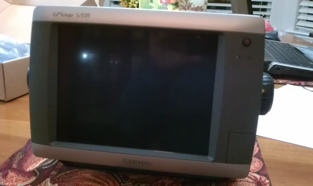
For off road I use the Garmin GPSMAP 5208. Has a very large screen, can load all Topo Maps, extensive costal mapping. I can also take it out of the Jeep and onto the boat to use as a fish finder. Can also be connected for radar and sonar.
What I like the best is that I can overlay weather maps over the topo maps and see the weather conditions of where I'm traveling, or over the entire USA.
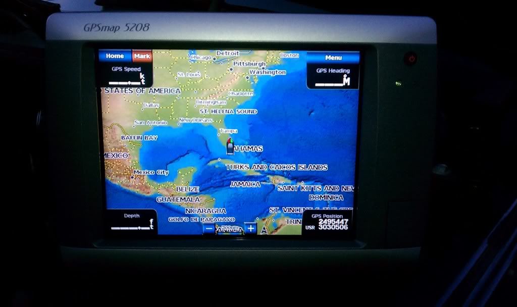
What I like the best is that I can overlay weather maps over the topo maps and see the weather conditions of where I'm traveling, or over the entire USA.
JK Freak

Joined: Aug 2011
Posts: 616
Likes: 25
From: Mesquite, NV
i'd use a garmin nuvi vehicle gps with an sd card that you can install topos on. handhelds are too small and not necessary. i have a 1490T and a 3790T. i like the 3790T because the graphics are better, has 3d graphics and it refreshes fast. i use the garmin topo maps. the 550 built in topo isn't detailed enough, you need a 24k topo.
JK Freak
Joined: Aug 2011
Posts: 616
Likes: 25
From: Mesquite, NV
i'd use a garmin nuvi vehicle gps with an sd card that you can install topos on. handhelds are too small and not necessary. i have a 1490T and a 3790T. i like the 3790T because the graphics are better, has 3d graphics and it refreshes fast. i use the garmin topo maps. the 550 built in topo isn't detailed enough, you need a 24k topo.
and one from the 3790T